Mapping Hungary: From Territorial Claims to Cartographic Satire
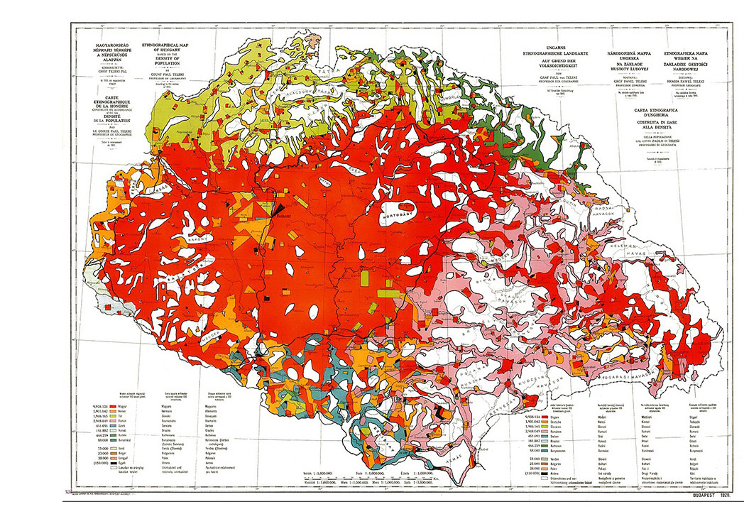
Maps played a significant role in constructing and contesting Hungarian national identity in relation to territorial changes following the First World War. One influential example is Pál Teleki’s Carte Rouge (1919), an ethnographic map produced in the context of the postwar peace negotiations. Based on the 1910 census, it represented the linguistic composition of the Kingdom of Hungary, using a striking amount and hue of red to emphasise Hungarian-speaking populations. Through its colour choices, reductive population-density representation and treatment of sparsely inhabited areas, the map visually reinforced the territorial unity of Greater Hungary. Presented as scientific evidence, it functioned as a political argument against the partitioning of Hungary at the WWI peace conference where it was also challenged for appearing as a propaganda image. Almost a century later, the Hungarian Two-Tailed Dog Party (MKKP) subverted the use of maps as nationalist territorial imaginaries through its satirical Make Hungary Smaller Again map. To ridicule political options mourning Hungary’s pre-1920 borders, the map proposes shrinking the country further to expose the political assumptions behind territorial nostalgia.
These examples demonstrate how maps can both legitimise and challenge dominant political narratives. While Carte Rouge mobilised cartographic authority to support territorial claims, the Two-Tailed Dog Party used visual satire to question the relationship between territory, national identity and collective memory.
These examples invite questions: How do maps transform historical territories into political claims? How do colours, boundaries and territorial shapes evoke national belonging? And how can humour and counter-mapping disrupt seemingly natural understandings of territory?
See also Segyevy (2019), 100 Years of Carte Rouge and The Two-Tailed Dog Party’s Make Hungary Smaller Again map.