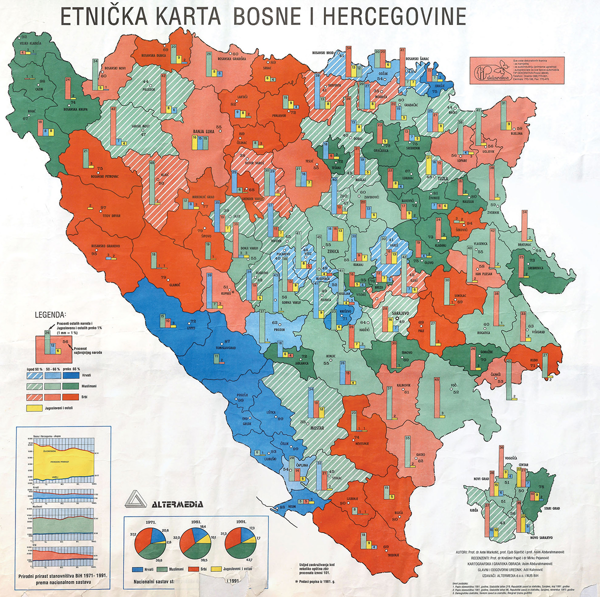
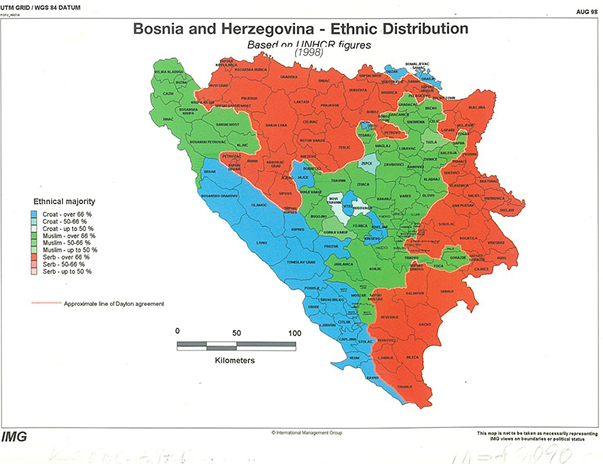
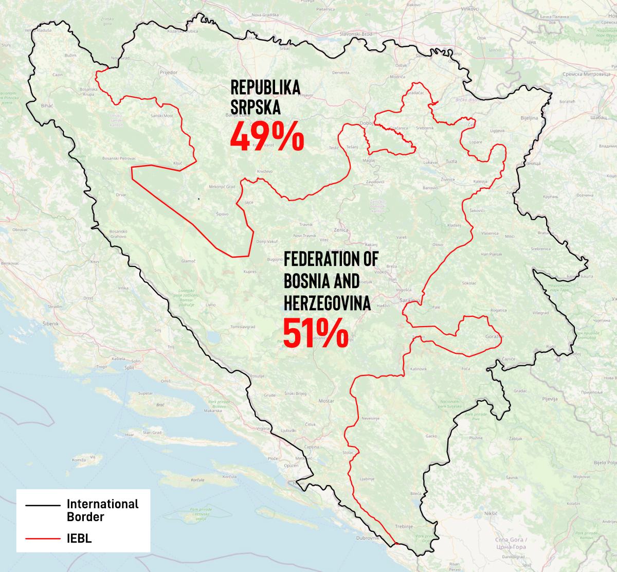
The 1990s war in Bosnia and Herzegovina was qualified as map-driven: it witnessed cycles of violence influenced by maps of ethnic distribution, land possession and territorial claims. The participants in the peace envisioned the future territorial division of the country while describing portions of its land as ‘empty’, ‘important’, ‘worthless’ or ‘theoretical’.
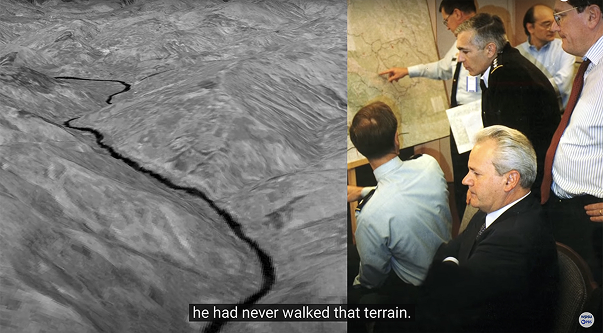
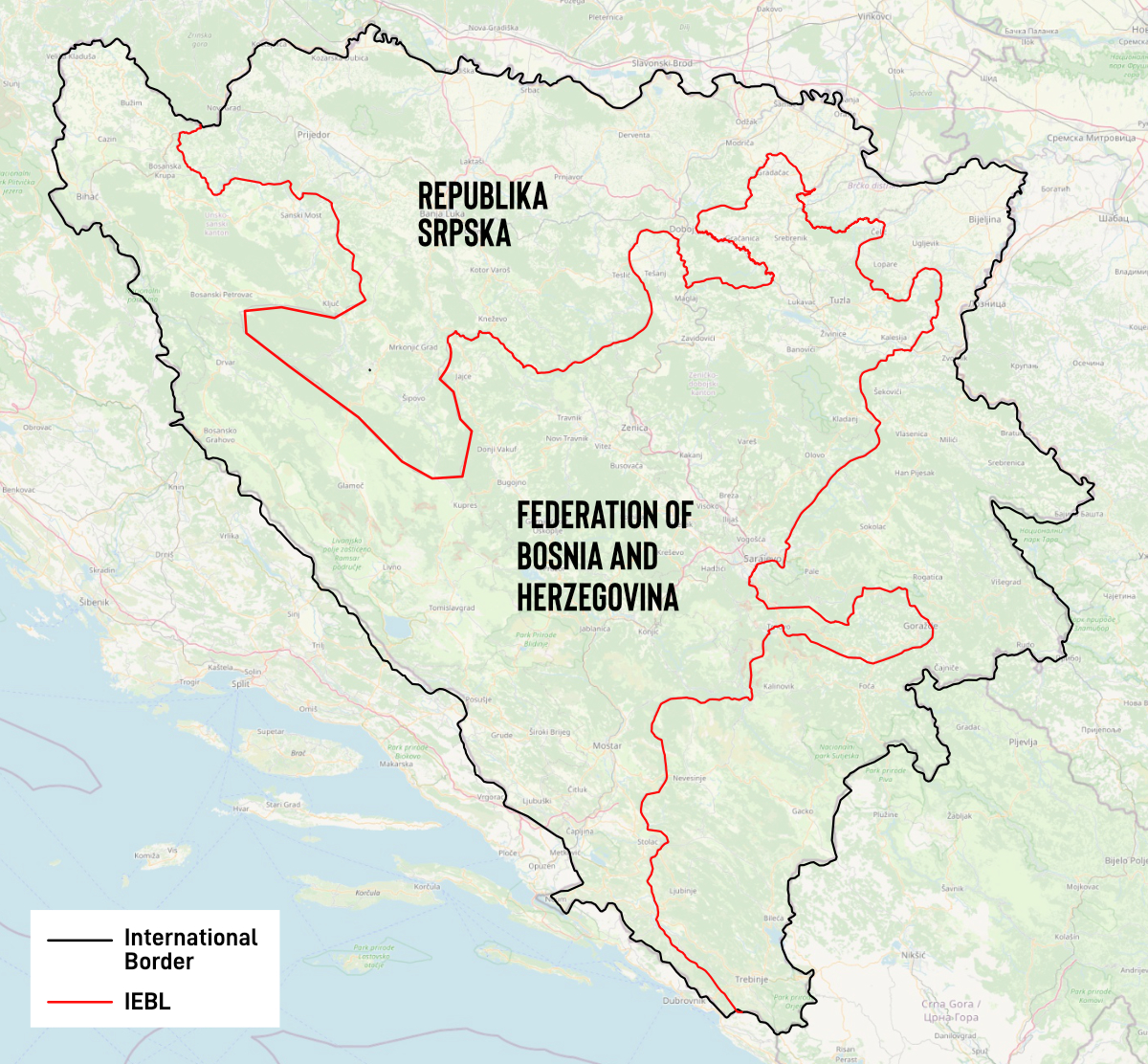
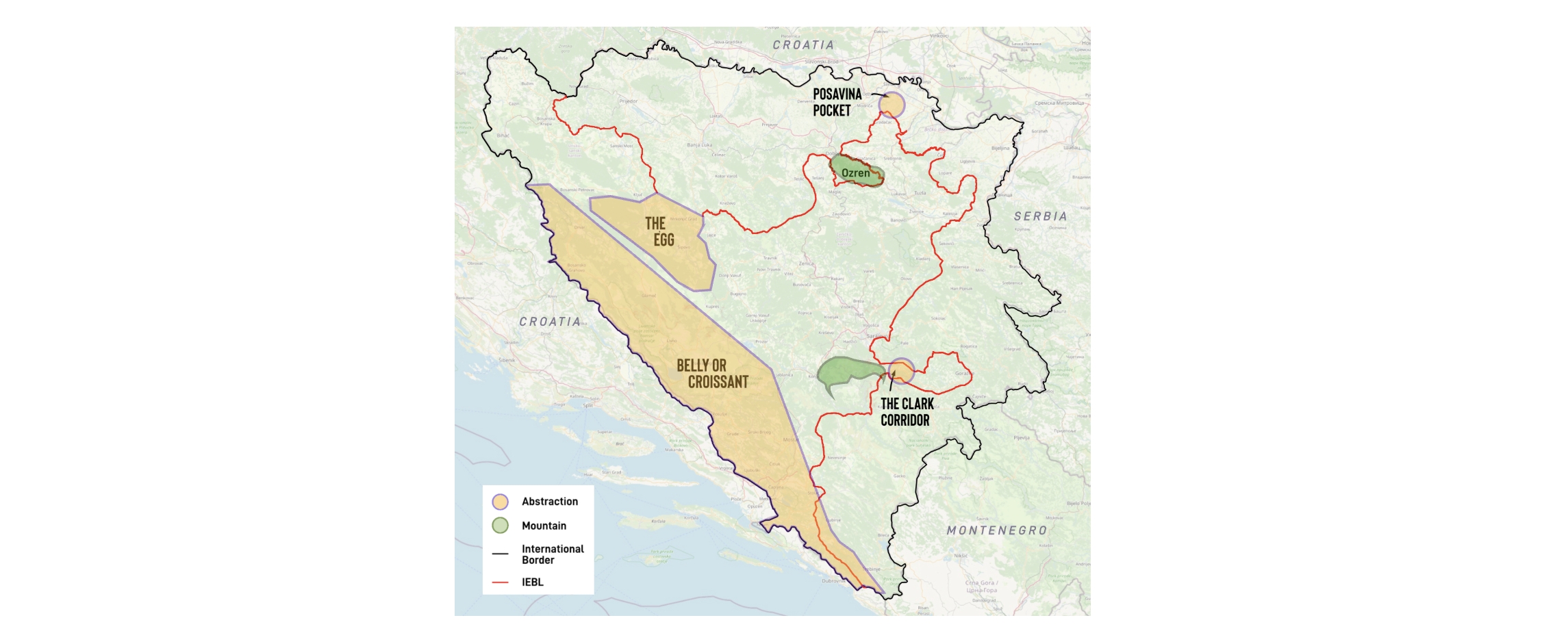
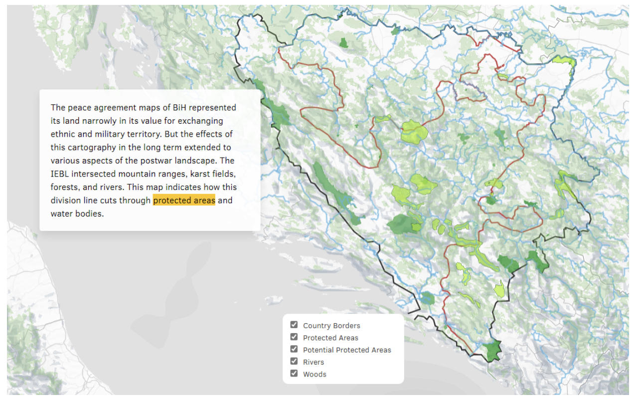
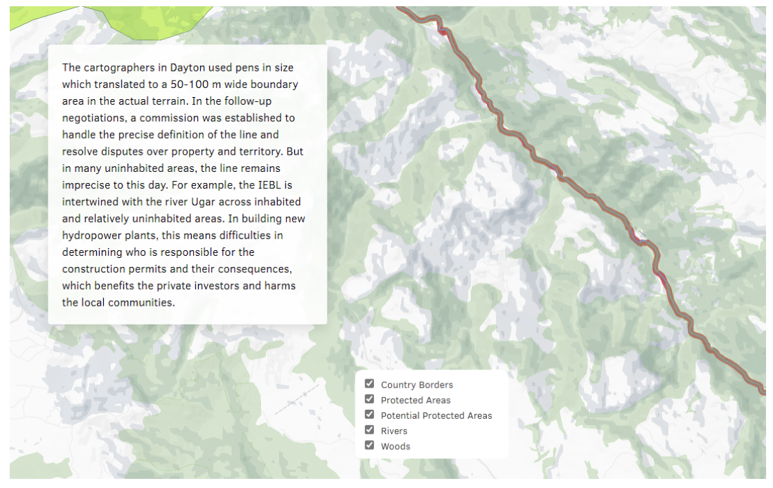
Peace agreement maps rarely saw land as anything other than ethnic property or military terrain. This “peace cartography” was a violent process of seeing the land from above to render it into an abstraction, removed from the complex spatial reality of Bosnia and Herzegovina. Legacies of violence remain with the division line that was drawn in finalising the Dayton Peace Agreement, which cut through cities, streets and houses—but also water and landscapes. Based on archival research and analysis of maps from the war in Bosnia and Herzegovina, as well as narrative accounts, media analysis and interviews, this project traces some of these landscape legacies of dividing Bosnia and Herzegovina with maps.