
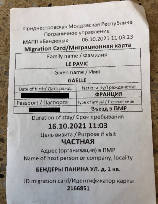
The ‘migration card’ I received when entering Transnistria on October 6, 2021. The card is granted until 16/10/2021 for a ‘private’ visit – as I did not know yet where exactly I would stay, the Transnistrian acting customs representative wrote a random address in the city of Bender, n°1 Panin Street.
ABOUT THE CASE
'Inside/Outside the Contested Border' presents fragments from Gaëlle Le Pavic’s PhD research and fieldwork tracing the contested borderlines between Transnistria and Moldova, and between Abkhazia and Georgia. In visualising this case, we experiment with ways of representing de facto states and their contested borders through blurred, shifting, and overlapping symbols. Through layered scrollytelling, we follow Gaëlle’s journey in the field, tracing how these borderlines are rendered visible through research practice.
In 1991, the dissolution of the Soviet Union resulted in fifteen independent republics and newly sovereign borders—some accepted, others contested, leading in several cases to conflict and war. This broader process underpins the separation of Transnistria from Moldova and Abkhazia from Georgia in the early 1990s.
Even the name Transnistria is contested. Moldova considers the territory an integral part of its sovereign state and refers to it as the Transnistrian region, while the region’s authorities refer to it as the Pridnestrovskaia Moldavskaia Respublika (PMR). In September 2024, the Transnistrian authorities formally banned the term Transnistria, equating it with “fascism” and “Nazism,” and promoting the Russian-language designation Pridnestrovie instead
Following centuries of shifting rule, the territory that is today referred to as Transnistria became part of the Soviet Union and was incorporated into the Moldavian Soviet Socialist Republic in 1940. Unlike most of present-day Moldova, however, it had not been part of interwar Romania. As the Soviet Union began to collapse, fears of Moldovan–Romanian unification, disputes over language policy, and disagreements over geopolitical alignment with Russia prompted Transnistrian elites to declare separation in 1990.
Armed conflict followed in 1992 and ended with a ceasefire agreement that allowed Russian troops to remain in the region as “peacekeepers”, a role that has been widely criticised. Despite maintaining a military presence, Russia has neither formally recognised Transnistria’s independence nor agreed to its annexation, despite a 2006 referendum in which a majority of voters reportedly supported closer integration with Russia. Today, questioning the relationship between Transnistria and Russia is criminalised in Transnistria, and thus, any expression of support must be critically assessed.
Following Russia’s full-scale invasion of Ukraine in February 2022, concerns emerged that Transnistria might serve as a staging ground for a second front in support of Moscow. No such escalation occurred. Somehow counterintuitively, the Transnistria authorities opened temporary shelters for Ukrainians fleeing the war. International organisations were permitted to operate alongside local ones, providing humanitarian assistance and limited social services to forcefully displaced Ukrainians.
While there are parallels with the relationship between Abkhazia and Georgia, important differences also emerged. Relations between the two were shaped by imperial competition and shifting arrangements of autonomy during Russian expansion into the Caucasus in the eighteenth and nineteenth centuries. Under Soviet rule, Abkhazia experienced fluctuating institutional status and periods of political repression, contributing to competing historical narratives and grievances.
As the Soviet Union disintegrated, diverging national projects, demographic tensions, and fears of Georgian dominance following the dissolution of the USSR, culminated in the 1992–1993 war between Georgian and Abkhaz forces. The conflict resulted in the mass displacement of ethnic Georgians and Abkhazia’s effective separation following the 1994 ceasefire agreement.
Interpretations of the war remain deeply contested. Abkhazian scholars emphasise that most combatants were local, presenting the military outcome as an expression of legitimate self-determination. Georgian scholars, by contrast, underline the decisive involvement of fighters from the North Caucasus, arguing that without their support, Georgia would have retained control over the territory.
The 2008 Russia–Georgia war and Russia’s subsequent recognition of Abkhazia’s independence further entrenched the dispute. These developments reinforced Georgia’s position that Abkhazia is Russian-occupied territory and contributed to the ongoing impasse in conflict-resolution efforts.
Access to Abkhazia and Transnistria has changed over time and remains fluctuating. After Transnistria’s separation from Moldova, entering the region was, as several respondents put it, “like going through an airport security check.” Access has eased in the last decade. I was able to enter twice, in 2014 and 2021. During my first visit, I had to complete paperwork and register within Transnistria; the second time, the procedure was easier. On both occasions, I received a slip of paper functioning as a “migration card,” since Transnistrian customs officers cannot stamp passports. During my 2021 stay, I conducted observations in Bender, Ribnitsa, and Tiraspol, and visited several civil society organisations (CSOs) providing social services in these locations. I observed their work and spoke with staff members. The visit was meant to be followed by a longer stay from March to May 2022, but Russia’s full-scale invasion of Ukraine made this impossible. Instead, I volunteered with a Moldovan grassroots organisation giving food, clothing, medicines, and hygiene products to Ukrainians fleeing to Moldova. I reflected on this painful and moving period in a blog post for the United Nations University (CRIS).
By contrast, access to Abkhazia—previously easier—has been heavily restricted since the COVID-19 pandemic. This has prevented many residents from visiting relatives and made on-site research impossible for (Western) scholars. I have therefore never been able to enter Abkhazia. Instead, I documented how the division with Georgia shapes social dynamics from the Samegrelo region, on the Georgian-controlled side. I reflected on the implications of this “non-access” in a blog post for the De Facto Research Unit at the University of Tartu.
Across three stays in 2021, 2022, and 2025, I conducted participant observation in Samegrelo CSOs, organised focus groups with social service users inside and outside these organisations, and carried out semi-structured interviews and informal conversations with a wide range of stakeholders. These included representatives of international organisations and donors working across the conflict divide. Some were international staff, others Georgian or Moldovan citizens, and one was an Abkhaz working for one of the seven UN agencies in Abkhazia.
These encounters and observations generated rich empirical material, accompanied by ongoing reflections on knowledge production. I remain aware that while I publish in (non)academic outlets and present at international conferences, many people living in the regions I study are excluded from such spaces due to limited (financial) resources, limited English proficiency, and other structural barriers. In an effort to challenge this imbalance, I am currently co-authoring an academic article with an Abkhaz scholar for submission to an English-language peer-reviewed journal.
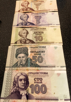
Transnistrian Ruble is issued by the “Transnistrian Central Bank” located in Tiraspol. This currency can only be used in Transnistria. I changed Moldovan Lei to obtain these Transnistrian Rubles. The character featured is Alexander Vasilyevich Suvorov (1729–1800), a Russian imperial military commander, involved in securing Russia’s southwestern frontier. He is traditionally credited with founding Tiraspol as a fortress town on the Dniester River.
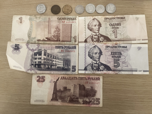
Interestingly, one of the 50 Ruble Transnistrian banknotes displayed the figure of Taras Shevshenko (1814-1861), a major Ukrainian poet. Ukrainian language is among the three languages recognised as official in Transnistria, together with Moldovan and Russian languages.
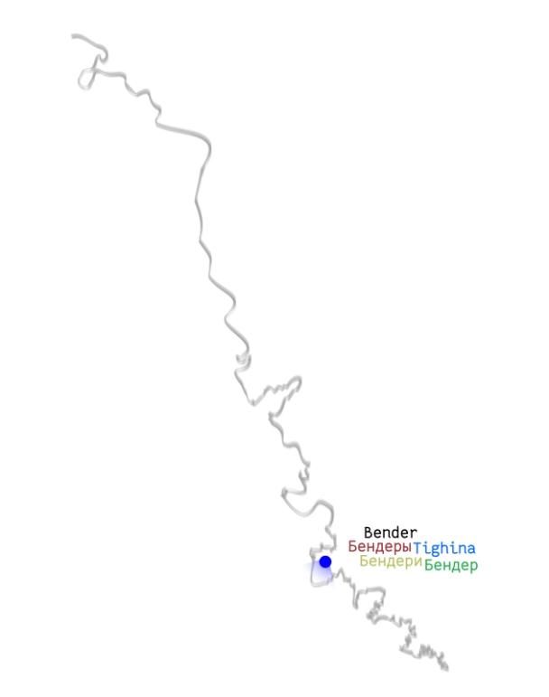
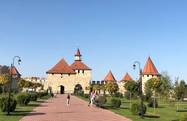
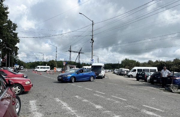
The first fortress I saw when I entered Transnistria after a 30-minute marshrutka drive from Chișinău was the one in Bender1, the only Transnistria-controlled major city located on the right bank of the river Dniester. Built during the Ottoman Empire in the late 15th-early 16th century, as a major stronghold to guard the Dniester frontier. The fortress changed several times during the Russo-Turkish wars of the 18th century and was eventually incorporated into the Russian Empire. The fortress remained a military site until the 2000s and was then restored and redeveloped as a museum and tourist site that I visited. European funds supported this restoration, but no mention to this is visible.
1 Bender is used in Transnistrian and Russian-language narrative, while Tighina is preferred in Moldovan and Romanian languages.
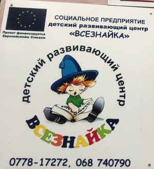
On the contrary, European support to the Transnistrian Civil Society Organisation (CSO) “Children Development Centre”, based in Bender, is visible with the flag and the mention, “project financed by the European Union”. Since 2018, a law in Transnistria has prohibited CSOs from receiving foreign funding if they engage in any kind of ill-defined political activities. However, CSOs providing social services can receive foreign (Western) funding. Yet, very few of them display it publicly.
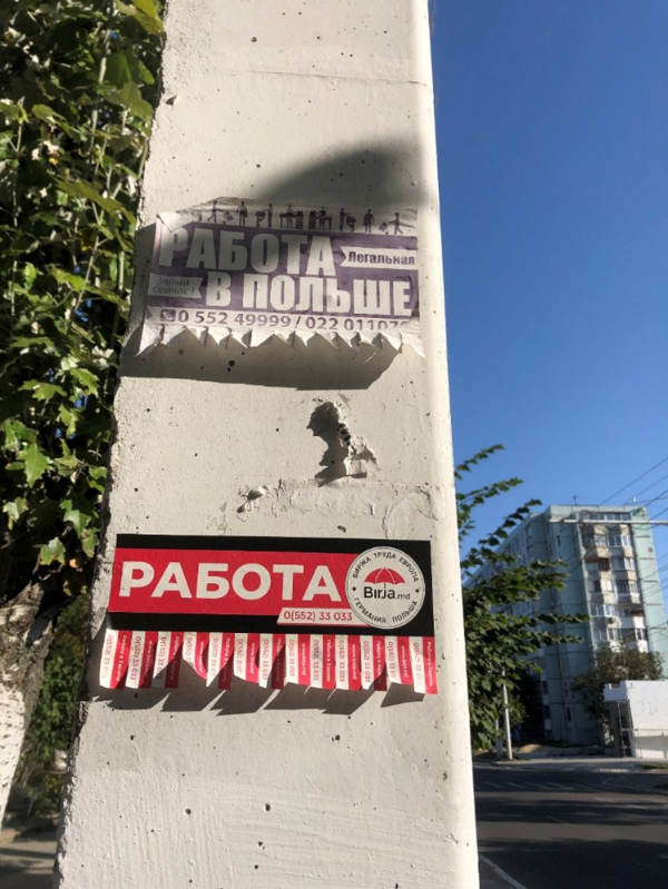
European presence in Transnistria is also visible via the attraction of its member state, which became a workplace for many Transnistrian inhabitants: “Work in Europe” and the mention of Poland and Germany are visible in one of the many small announcements to “work” in different European Union countries, such . One of my interviewees mentioned that many in Transnistria used to work in Russia, but this has changed, especially since the introduction in 2014 of a visa-free regime with the EU for 90 days for Moldovan passport holders. Many in Transnistria hold a Moldovan passport.
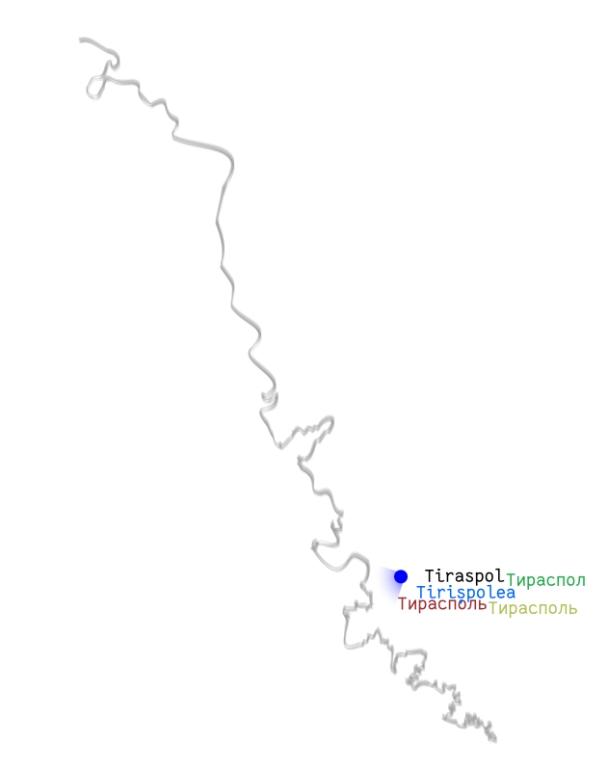
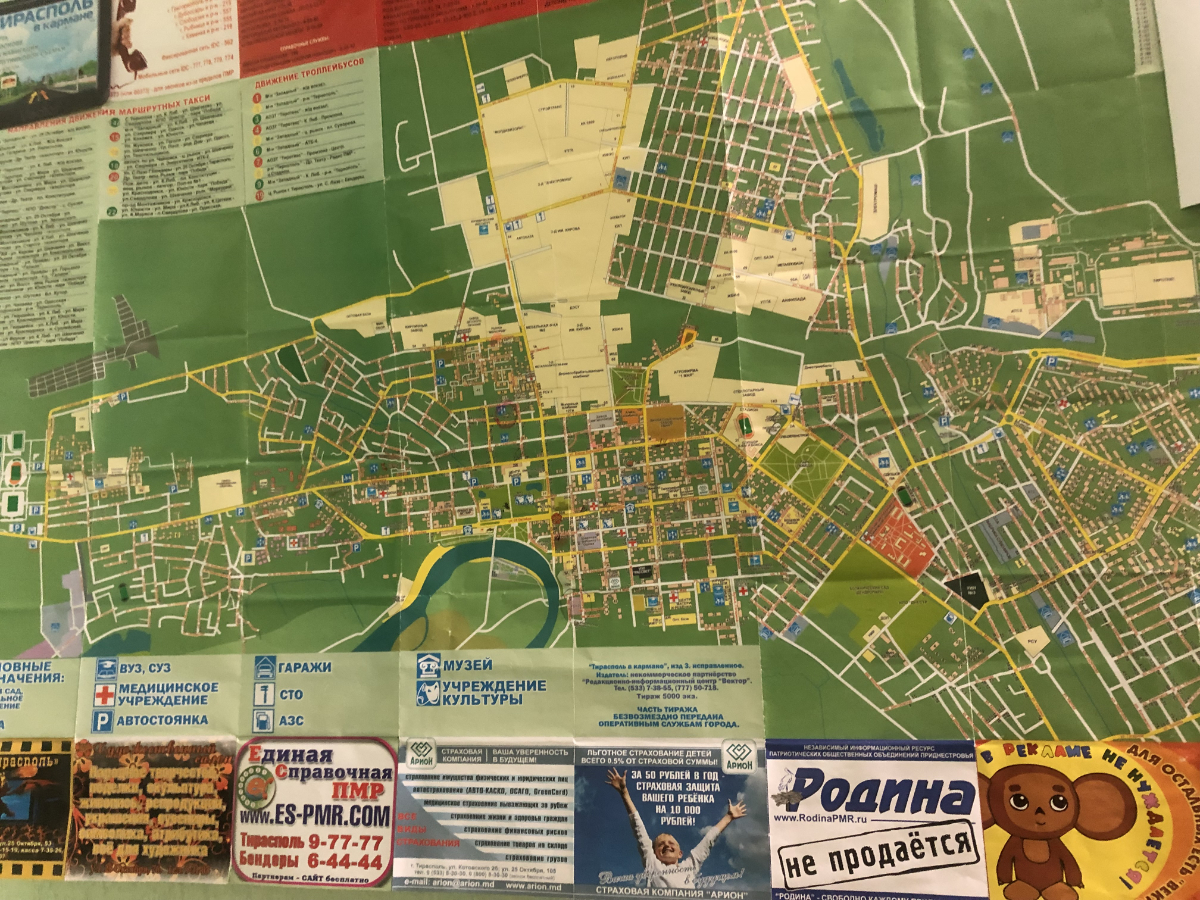
Map of Tiraspol, the administrative, political, and symbolic centre of Transnistria, one announcement reads: “the motherland is not for sale”. What struck me during my first visit in 2014 was the display of sovereignty symbols such as police forces, flag, coats of arms, and the major use of the Russian language (as figured in the map).
When I visited Tiraspol in October 2021, I pictured this status figuring a horse-rider and the figure 31, marking the 31 years of Transnistria’s unilateral separation from Moldova in 1990. Up until today, Transnistria has not been recognised by any other sovereign country.
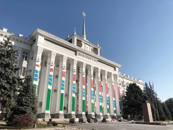
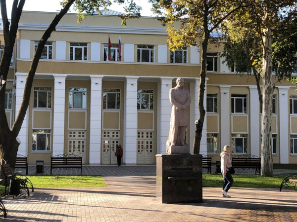
The Dom Sovetov (Дом Советов, “House of Soviets”) used to host the local and regional soviet and is now used for Transnistrian de facto government institutions, thus contributing to a performance of governance and sovereignty where former Soviet institutions are transformed to do new political work. The statue standing in the front features Lenin signalling a rejection of the de-Sovietisation movement at stake in many places that used to be included in the USSR.
Contrasting with the Lenin statue, the one of Taras Shevchenko, the Ukrainian poet, stands in front of the building of the “Taras Shevchenko Transnistria State University (PGU)”, the main higher education institution in Transnistria. It is hosted in the pedagogical institute founded in 1930. interestingly, this statue has become a rallying point of Ukrainians living in Transnistria during celebrations such as the “National Flag Day”. About 25% of the Transnistrian population self-identifies as Ukrainian. As of 2025, about 9000 Ukrainians are forcefully displaced to Transnistria due to Russia’s full-scale invasion.
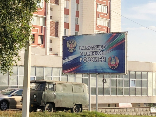
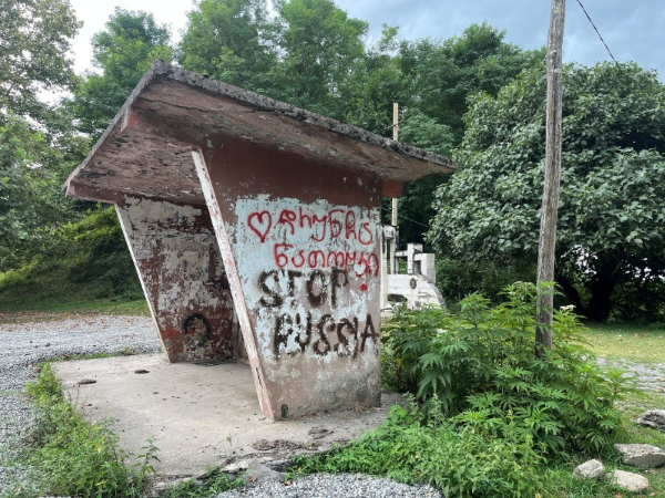
Offering a striking contrast with the Taras Shevchenko statue, this billboard in Ribnitsa reads “For a future with the great Russia” that I pictured in October 2021. The billboard features the coats of arms of Russia (top-right) and Transnistria (bottom left). This symbolises a pro-Russian attitude, at least of the Transnistrian authorities in charge.
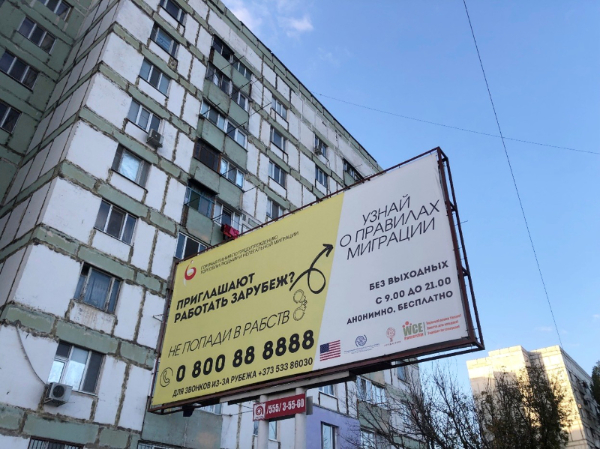
Billboard a meter away from the previous one featuring “For a future with the great Russia” in another street of Ribnitsa: side in yellow: “invited to work abroad, do not end up in Slavery”; side in white: “know about the migration rules” “without break from 9 am to 9 pm” “anonymous, free of charge”. The billboard publicizes a hotline to help (potential) victims of domestic violence and human trafficking. The services were supported by the International Organisation for Migration (IOM), USAID, an International Non-Governmental Organisation and operated by a local civil society organisation. Initially, the phone number did not account for the phone dial difference in Transnistria, rendering the number more expansive for Transnistria-based population. Donors accepted to change the number at the demand of the CSO operating the hotline. This example shows the impacts of unrecognised borders and statehood on access to social services.
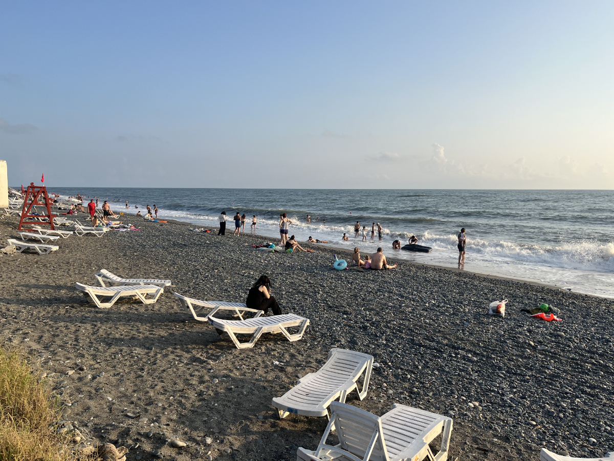
Ganmukhuri beach pictured in August 2025. On the black Sea, the beach is both a resort and a site of the contested border between Georgia and Abkhazia. Both functions coincide next to each other. The camouflage bunker that we see on the picture is part of a security zone controlled by Georgia. One of my interviewees referred to this a “a buffer zone” between the Georgian and the Abkhazian controlled territories. Several respondents mentioned that he presence of the Russian FSB forces since 2012 has tensed the situation, ending most of the informal practices that mitigated the impact of the contested territorial divide, cutting across a space where dense economic-social ties exist.
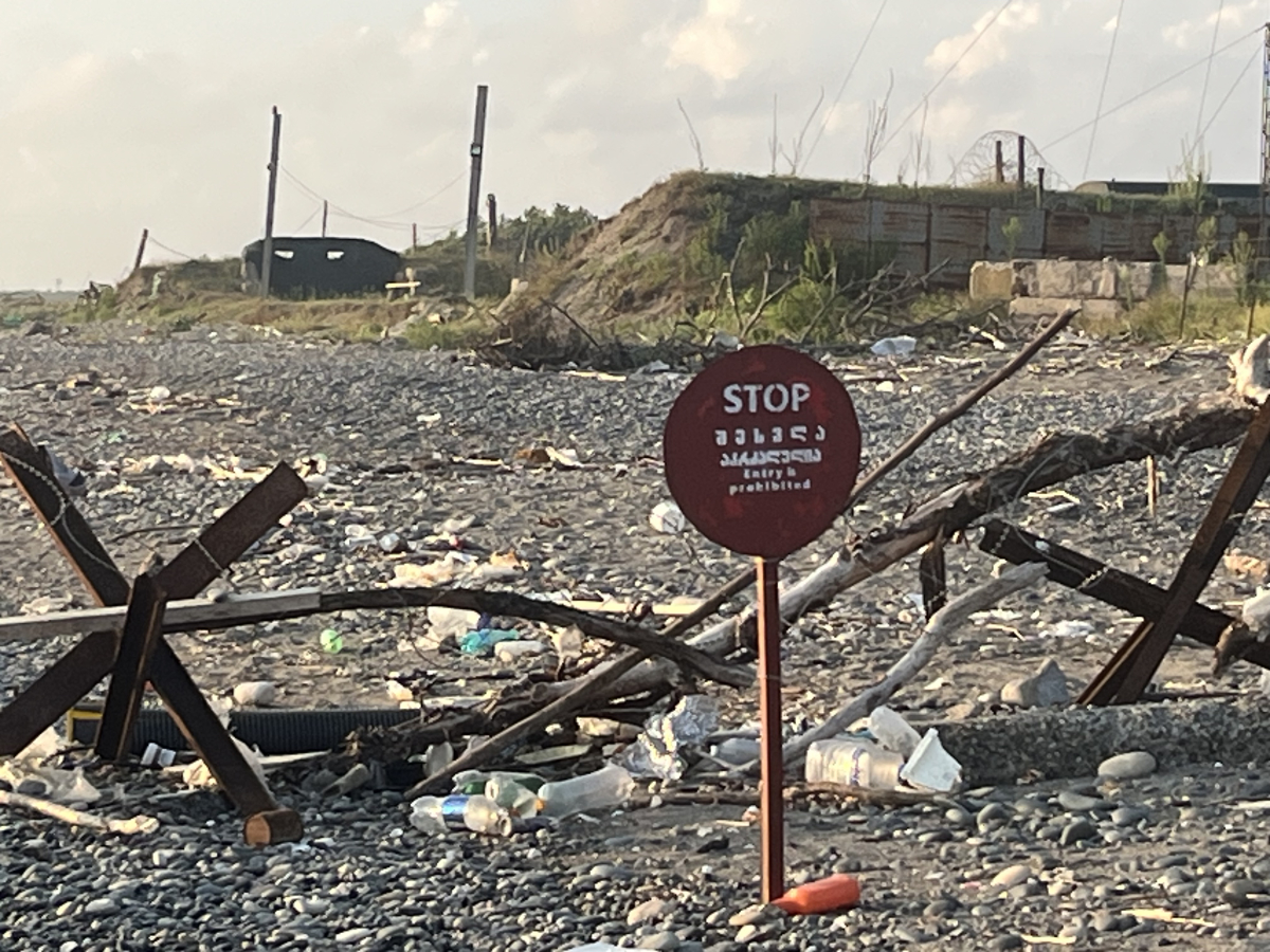
The same beach, just 100 meters from the other side of the previous picture, featuring the stop sign and the camouflage bunker. A striking contrast showing how daily life unfolds amid securitized environments.
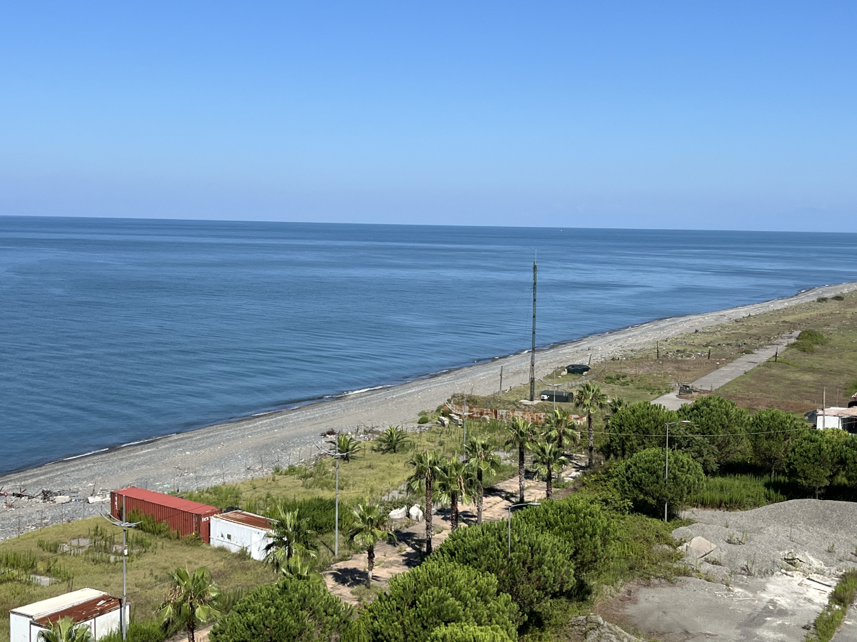
Same beach viewed from above, we can barely see the contested border between Georgian and Abkhazia-controlled territories, yet it’s there. The bunker’s roof is visible, and further, there is a Russian military base.
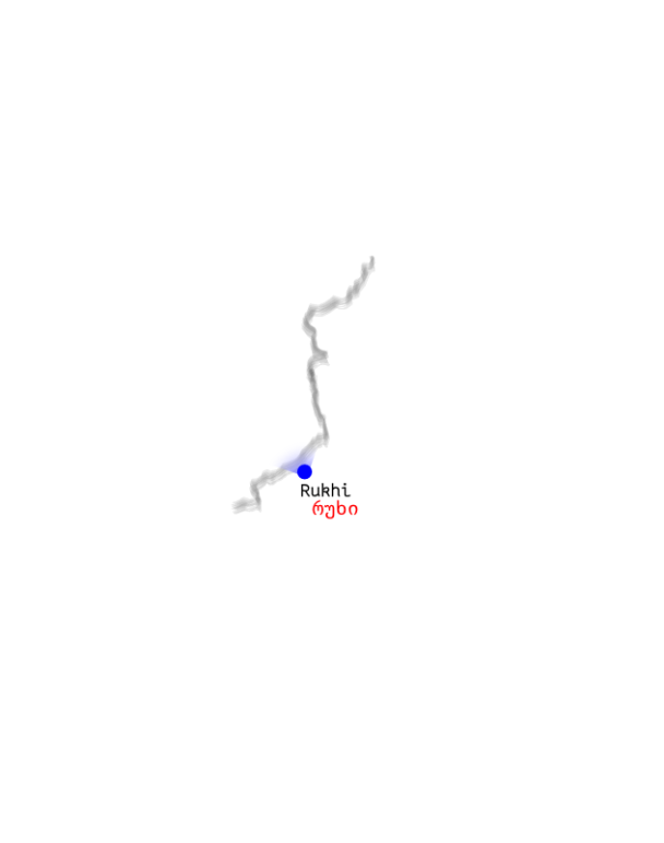
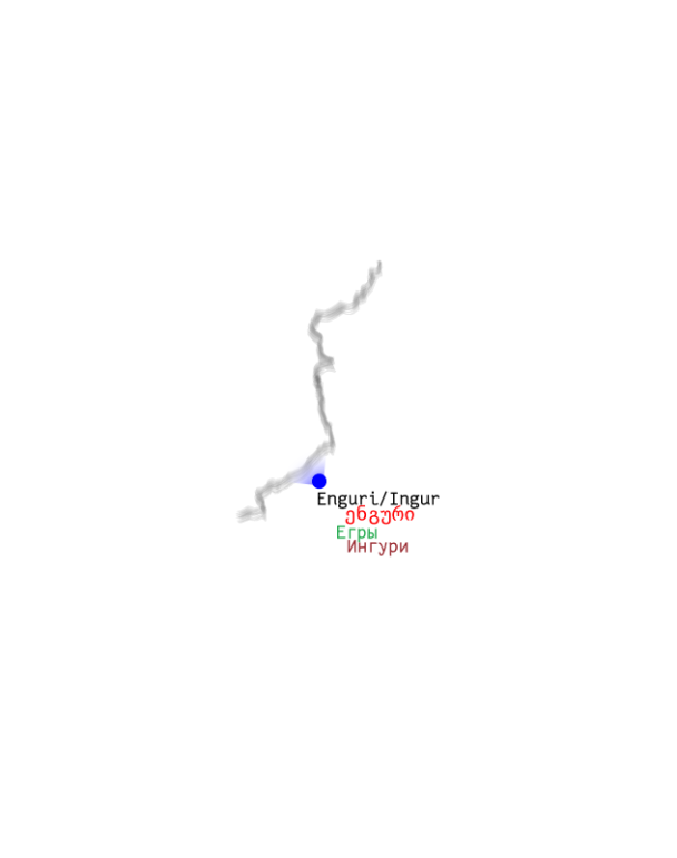
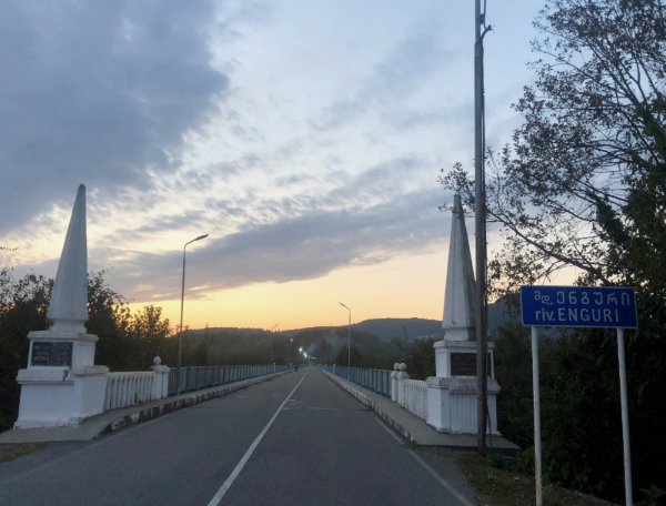
Bus stop in the Rukhi village – the last one before the “controlled crossing point” at Enguri (Georgian version)/ Ingur (Abkhazian version). Since the closure of three other crossing points between the territories controlled by Abkhazia and Georgia, Enguri/Ingur is the main one, with on average 2500 crossings daily, marked by important seasonal variations.
In some parts, the contested border is visible, as here, it is marked by barbed wire that I pictured in August 2022. Georgia considered this as part of a “creeping broderisation strategy” undermining Georgia’s territorial sovereignty. On the contrary, Abkhazian authorities and part of the population continue to see Russia as a “security guarantee” against Georgia, even after Russia’s full-scale invasion of Ukraine. However, the role of Russia is also debated in Abkhazia, including publicly by journalists, political analysts, and civil society representatives.
The visible, barbed wire and ditches pictured in August 2022, part of the same above-described dynamics.
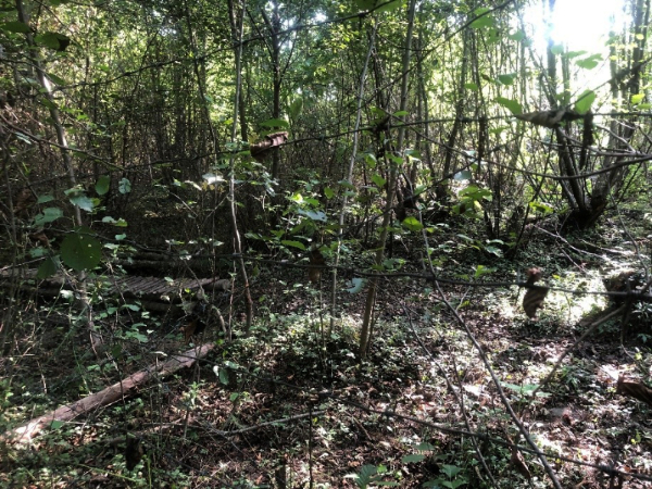
In some sections the divide between the Georgian and Abkhazian-controlled territory blinds in nature, like in this picture. Only by taking a closer look, one may be able to see a metallic tower at the top of the left corner, which stands on the Abkhazian side and is used as a surveillance device.

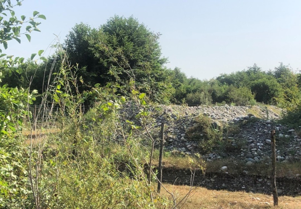
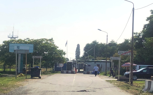
Another example of the blinding of the divide into a flourishing natural landscape, in the vicinity of the Phakhulani/Saberio controlled crossing point, which I pictured in 2022.
Controlled crossing point at Phakhulani/Saberio, August 2022, Georgia; to access this area, a special permission from the Georgian police is necessary, and the Georgian police filter the access to this second pedestrian-only “controlled crossing point” or checkpoint. The flag waving is the Abkhazian one, the sign reads “stop control” in Cyrillic, the billboard is in the Abkhazian language, and an observation and communication tower stands on left-top corner. This scenery illustrates the humanmade character of borderization, understood as the process of border edification, here in a situation of territorial contestation.
The “controlled crossing point” at Enguri – before crossing the bridge – August 2025. This crossing point is the main one, and is especially busy in the summer period due to family visits, hazelnut picking and trade activities. Enguri/Ingur is the only crossing point where cars can cross. Many are also using a mashrutka, while some cross by foot. Any car crossing must change its registration plates. A shop on the Georgian-controlled side is selling Georgian registration plates, and most likely, another shop is doing the same on the other side, turning the contested border into a source of (small) income. During my previous visit in 2022, “duty-free shops” opened on the Abkhazian-controlled side, amid a warmongering rhetoric on a “possible second front”. Izida Chania, an Abkhazian journalist, published an article in the Echo Kavakz titled in Russian Воюем или торгуем? Are we at war, or are we trading?. This emphasises the instrumentalisation of the territorial divide to serve the antagonist goals of the minority in charge, while for the majority in Georgia, the territorial divide remains a burden.
The “controlled crossing point” at Enguri – on the bridge – August 2025. A mashrutka and a pedestrian are crossing.
The “controlled crossing point” at Enguri / Ingur – just before crossing the bridge - October 2021. On this Friday evening, the bridge is almost empty, and only two pedestrians crossed during my 1-hour observation. A member of a local civil society organisation had negotiated our access to this point of the bridge with the Georgian police. Parliamentary elections were held at that time in Georgia, and both sides accused each other of closing the bridge to prevent Georgians residing on the Abkhazian-controlled side from casting their vote in Georgia. They tend to vote mostly for the National Movement, the opposition of the current ruling party, Georgian Dream.

EUMM monitor observing what is framed by the EU and other international organisations such as the UN as an “Administrative Boundary Line (ABL)” between Georgia and Abkhazia pictured in 2025. the EU monitoring mission (EUMM) was set up in September 2008 in the aftermath of the Russian-Georgia war over South Ossetia, also spanning Georgia and Abkhazia. Although EUMM’s mandate covers both Abkhazian and Georgian-controlled territories, effectively, the mission is limited to observations on the Georgian-controlled side. The EUMM documents new signs of borderization, such as the erection of an observation tower or additional barbed wire, yet it cannot take any action to prevent or dismantle them. In contrast, Russia’s recognition of Abkhazia as a state facilitates Russia’s engagement not only in political and strategic areas but also in economic and social aspects. More than three decades after the Agreement on a Cease-fire and Separation of Forces was signed by parties to the Georgian-Abkhazian conflict in Moscow on 14 May 1994, Abkhazia and Georgia remain separated. The delimitation, which has evolved into a contested border, framed differently by the different sides, runs along a security zone, where activities such as hazelnut picking, fishing, and beekeeping unfold, yet all the houses I could see have been vacated by their owner, resulting in a securitised emptiness.
In the Georgian–Abkhazian context, the security zone refers to a set of spatial, legal, and military arrangements established after the 1992–1993 war to separate forces, prevent renewed hostilities by ensuring a restricted weapons zone, and manage movement along the ceasefire line as foreseen by the 1994 Moscow Agreement on a Ceasefire and Separation of Forces. It is an example of how “temporary” security arrangements become durable regimes, with a buffer space that has been empty of its inhabitants and is punctuated by several checkpoints, patrol routes, and observational points. These arrangements affect villages, agricultural land, and everyday mobility. Yet the zone works asymmetrically, fostering uncertainty on the Georgian-controlled side and providing a form of reassurance on territorial control on the Abkhazian side.
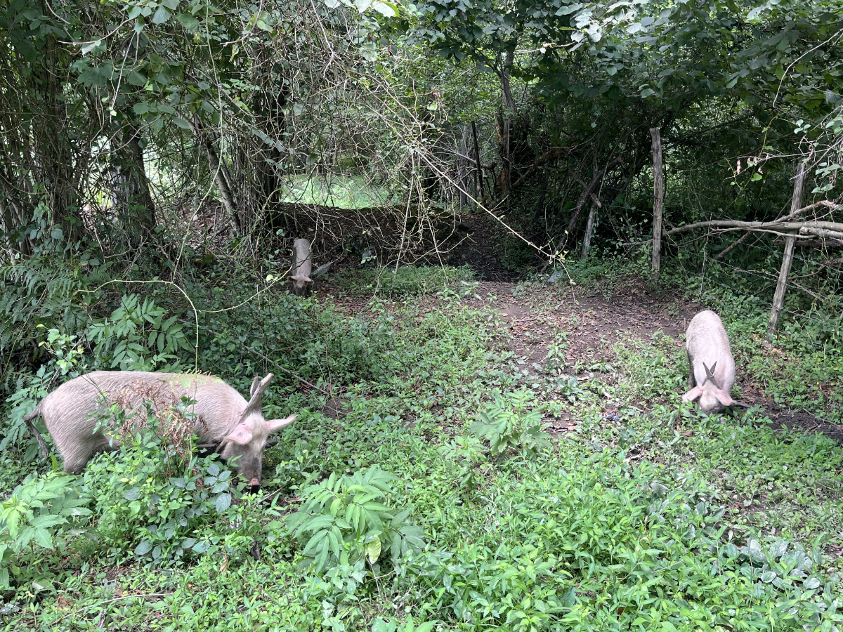
Pigs wandering in the security zone (August 2025). Interestingly, animals are mostly free to wander in the Samegrelo region. It is mostly easier for them to navigate across the territorial divide than it is for human beings. During a previous epidemic of pig fever, vets from both Georgia and Abkhazia collaborated to contain the spread of the disease, with the support of an international non-governmental organisation.
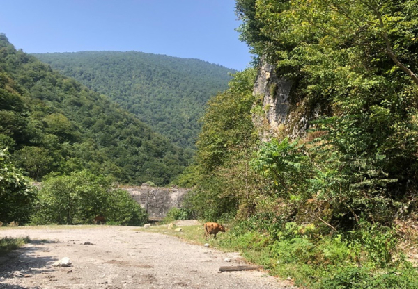
Cows wandering in the security zone (August 2022).
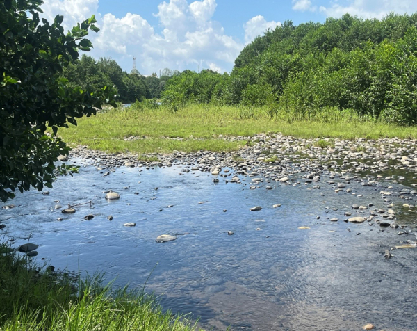
The Enguri/Ingur Dam (part within the security zone – August 2022) - Built between 1961 and 1987, it remains today a main site of post-war interdependence between Georgia and Abkhazia, as the dam was designed as a single, integrated Soviet system. As noted by the EU monitoring mission, the Enguri Reservoir lies behind the dam on the upstream side in the Samegrelo region of Georgia. The powerhouse and generators of the Enguri Hydropower Plant are located downstream in the Gal/i district on the Abkhazian side, fed by water carried through a long underground tunnel from the reservoir behind the dam.
The Enguri/Ingur Dam illustrates a form of Georgian–Abkhaz interdependence, and as such is identified as both a facilitator of cooperation and a site with latent potential for weaponisation. Regulated by a 1997 agreement allocating 40 percent of electricity to Abkhazia and 60 percent to Georgian government-controlled territory, corresponding to the controlled-territory shares, the dam sustains a form of technical, everyday peace without resolving the underlying conflict.
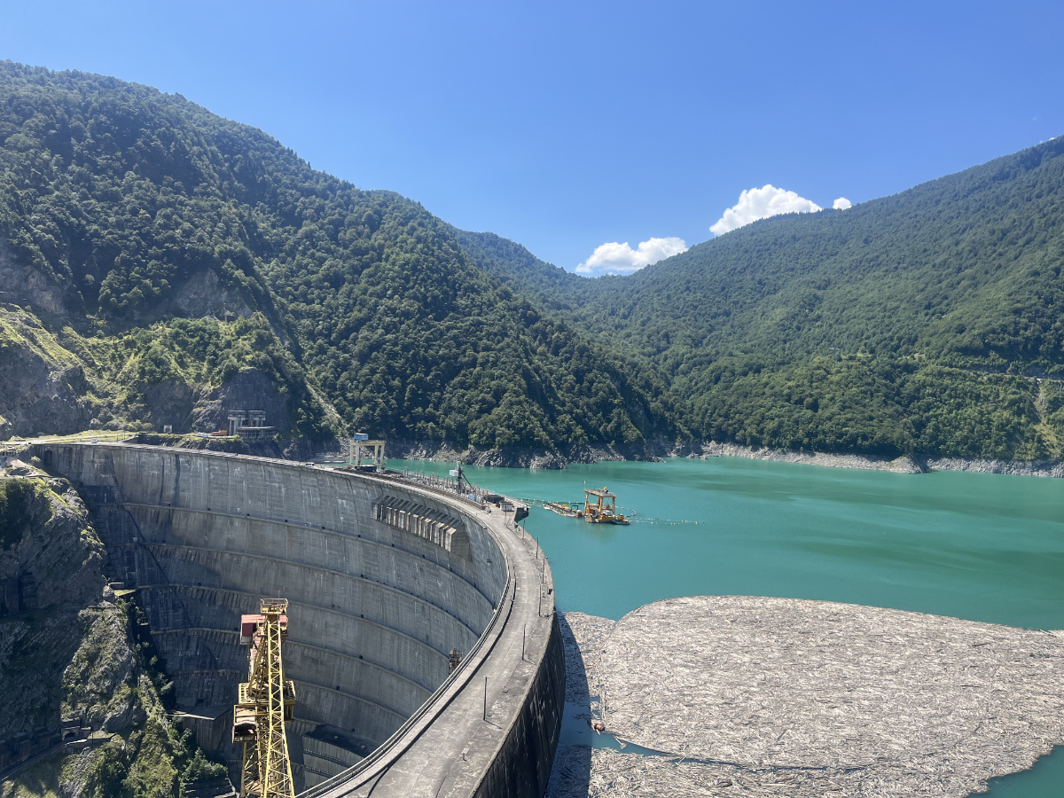
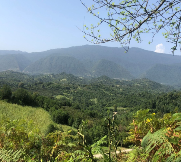
Although parts of the facility are heavily securitised and monitored by forces on all sides, the Georgian-controlled side has also been developed as a tourist site, as featured in the pictures above
Although Abkhazia and Transnistria are frequently described by international observers as “frozen conflicts,” my research over the past six years points instead to the ongoing social, political, and spatial dynamics that shape everyday life in both contexts. The absence of renewed large-scale hostilities does not imply stasis. In the Georgian–Abkhazian borderland, daily life unfolds within an increasingly securitised environment, including surveillance practices, restrictive regulation and increasingly restricted crossings, shaping what can be understood, following Anzaldúa, as a borderland marked by overlapping physical and metaphorical boundaries, where cultural, social, and emotional tensions unfold. Movement across the dividing line remains possible but conditional and unpredictable, impacting family life, economic livelihoods, and access to social services. Transnistria, by contrast, has experienced a different trajectory. While access to the region was once tightly restricted, mobility has gradually become more routinised, facilitating trade, commuting, and access for international actors.
Russia’s full-scale invasion of Ukraine reverberates across both territories, generating renewed speculation about potential “second fronts” and reshaping perceptions of vulnerability and alignment on all sides. If Transnistria’s proximity to Ukraine situates it within immediate wartime anxieties, Abkhazia’s demarcation with Russia, often described locally as the “only window to the outside world”, " places it within a (geo)political dependency, which is contested within Abkhazia itself. In both cases, what is often labelled as frozen conflict is better understood as a condition of managed uncertainty and lived negotiation rather than immobility or static, monolithic alignment.
ABOUT THE AUTHOR
Gaëlle Le Pavic is a postdoctoral researcher and lecturer at Ghent University and an Associate Research Fellow at UNU-CRIS; she conducts research in three directions 1) the intersection of social services and geopolitics 2) the social consequences of borders and border contestations 3) knowledge production and ethics in research. During her PhD research, she focused on access to social welfare and social services within and across contested borders with Abkhazia and Transnistria as case studies. Her research investigates specifically the role of civil society organizations in facilitating this access within and across de facto borders.
Roles
Author: Gäelle Le Pavic
Visualisations: Mela Žuljević
Photography: Gäelle Le Pavic
Advisor: Jana Moser
Feedback: Anja Kurth
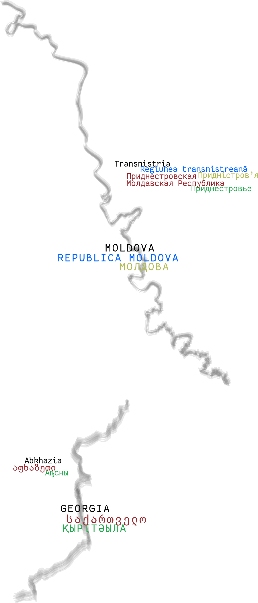
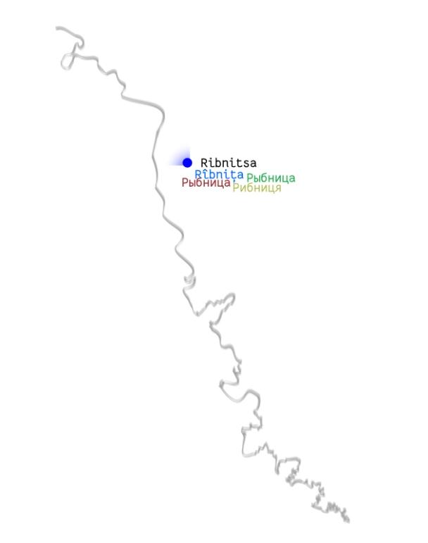
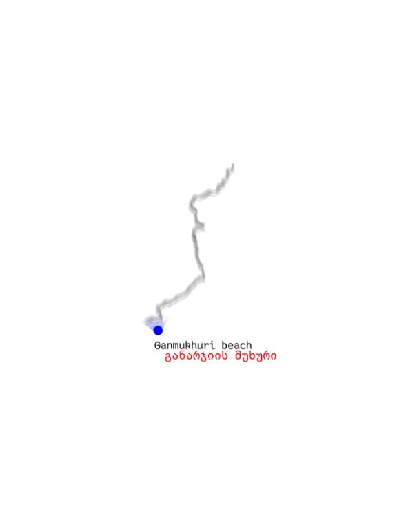
VisLab: The introductory map visualises the boundary lines between Moldova and Transnistria, and Georgia and Abkhazia by using a blurred line as a symbol for contested borderlines. The overlapping labels attempted to indicate the contested name of the region while experimenting with questioning the hierarchy of languages. We made several versions of this visualisation. Starting from visualising the de facto states as enclosed entities, we shifted towards focusing on the borderlines. First, we made a mistake to show these as borders between two equal entities. In the next step, we applied a hierarchy and position of labels aligning with the internationally recognized territorial integrity of Moldova and Georgia.
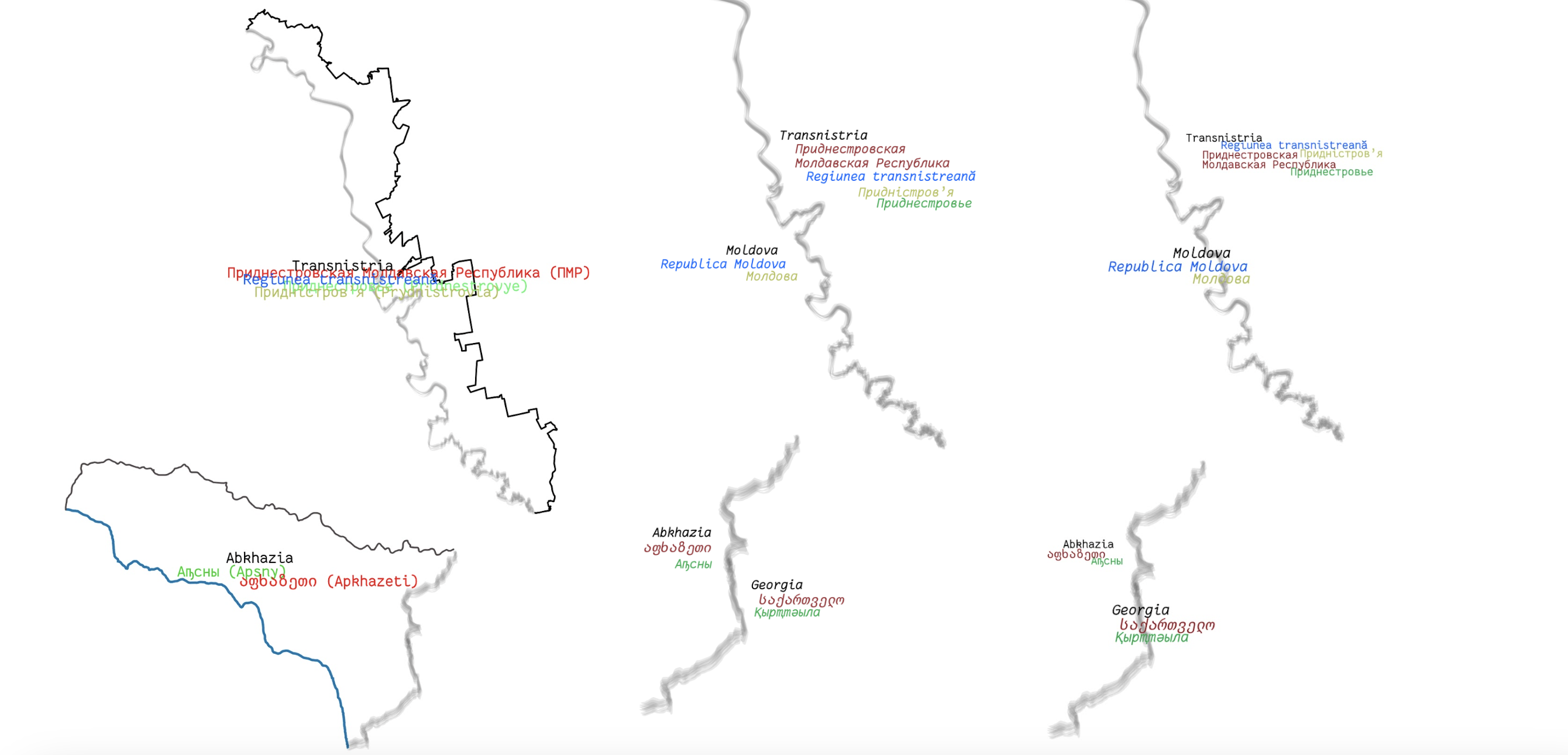
Gäelle: Representing border contestation is always challenging, since the very term border is contested, showing a border-like line between Abkhazia and Georgia or between Moldova and Transnistria immediately triggers reactions. Yet, my research shows that some in Transnistria, and in particular in Abkhazia, want to see this contested demarcation as a sovereign border. We therefore discussed how to best visualise this contestation. It is important to emphasise that despite multiple attempts, I could never enter Abkhazia and document social realities on the other side of what I frame as a contested border. This creates a distortion between the two case studies that are thus not visualised in the same way. While Transnistria is represented from within, Abkhazia is only sketched from the edge, and the focus is much more on the border contestation, processes of borderization and securitisation.
Overlapping labels
VisLab: The use of overlapping labels was initially considered as a good strategy to indicate the contested borderline through the lens of various languages used to name the area. However, this compromises the legibility and clarity of the map, introducing confusion. While this can be an interesting strategy, we decided to reduce the overlap but still attempt to confuse the hierarchical representation of labels.
Gäelle: Language diversity and the names that places carry in different languages are a key aspect to capture this contestation. We thus had some discussion about how best to show this complexity, with overlapping names, yet making them clearly visible.
Overlapping layers
VisLab: The backend module of “Scrolling Layers” was developed to visualise this project, as the idea was to show it as an ethnographic journey, where the researcher traces and records how the borderlines are made visible or invisible by how they appear to her in the field. We indicate the position of the researcher on a map first, then overlay it with field observations in photos and texts. The idea was to continue this process by inventorising different ‘appearances’ of the borderline, e.g. documents, currencies, signs, etc. But we gave up on this idea as it seemed that systematising them might not add any relevant insights to this work.