ABOUT THE CASE
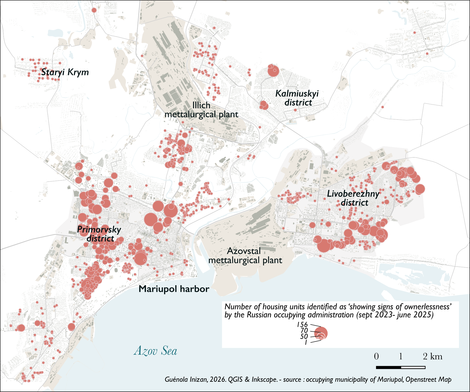
Using mapping to visualise lists of dwellings declared “ownerless” in the occupied areas of Ukraine, the case shows how administrative records can reveal patterns of dispossession. By mapping fragmented datasets (such as in Mariupol, where about 11% of surviving housing appears to have been "municipalised") it exposes how a technical process functions as a territorial strategy for reassigning property while obscuring how buildings are labeled “abandoned.”
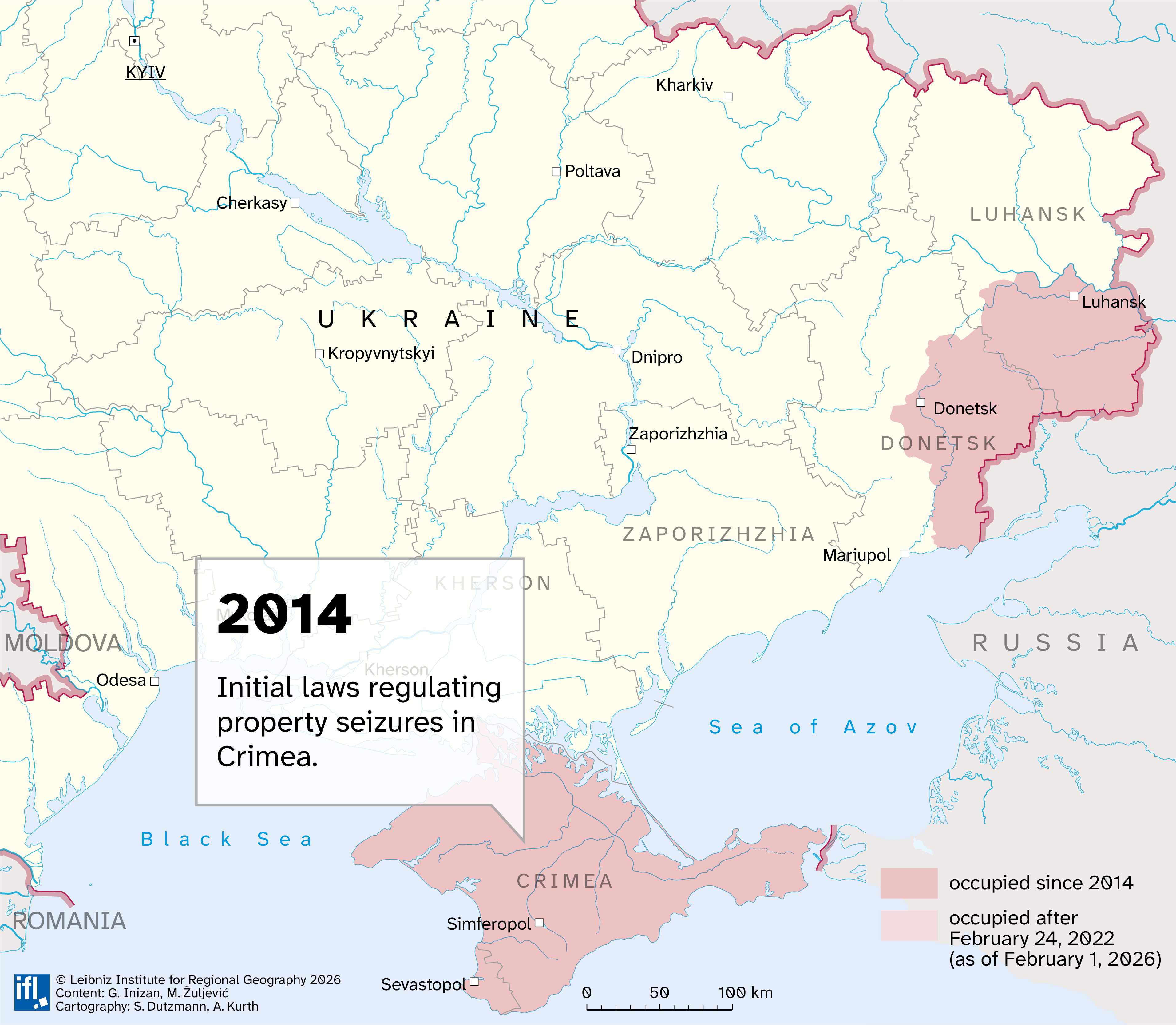
Since 2014 in Crimea and the self-proclaimed "Republics of Donetsk and Luhansk", and since 2022 in the four annexed regions of southeastern Ukraine (Donetsk, Luhansk, Zaporizhzhia and Kherson), the Russian occupying administration has implemented a legal framework to govern various aspects of social, political, and economic life. This concerns all sectors, from those the most obviously linked to the State-building (such as the distribution of citizenship through the “passportization” policy) to more localized issues, such as water and electricity management.
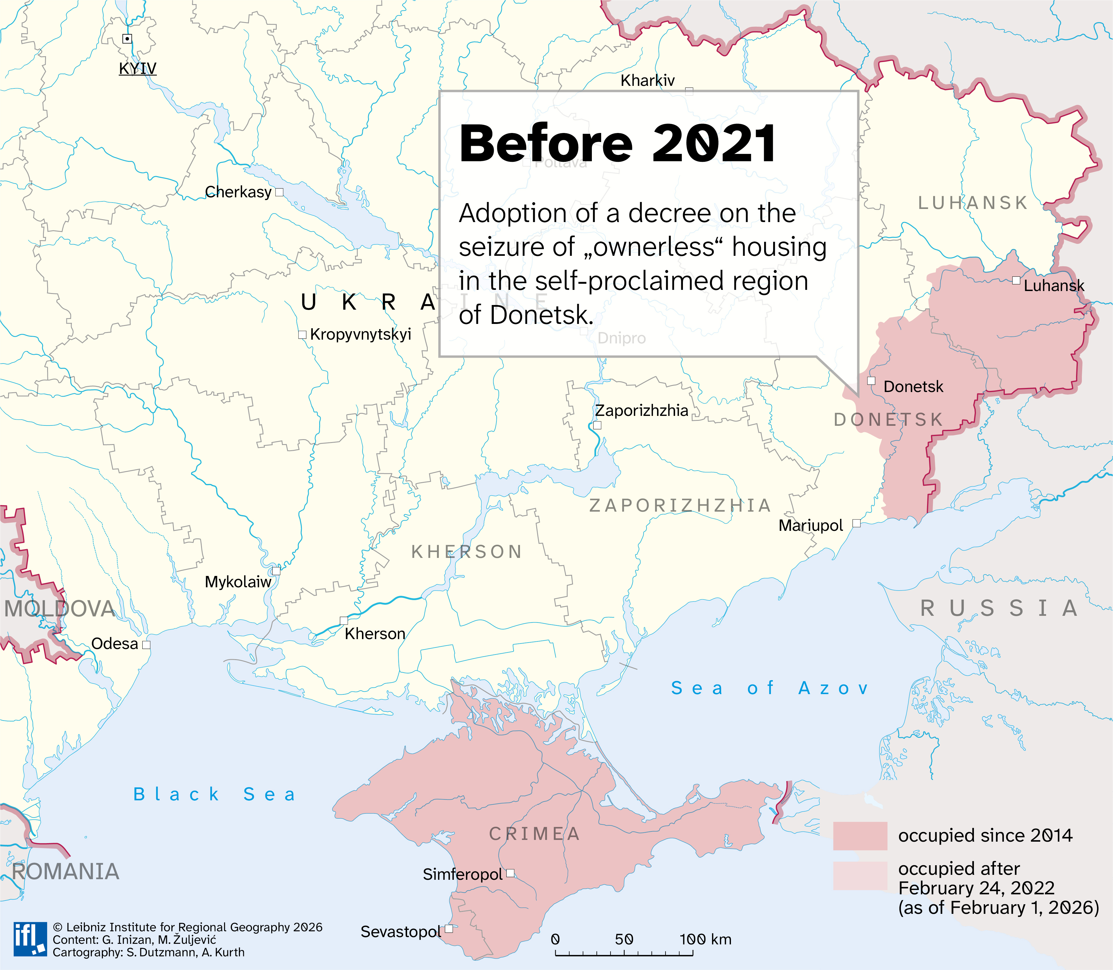
One of the dimensions of Russian occupation administration concerns the management of dwellings abandoned by people fleeing the war and the occupation, or whose inhabitants were killed during the war. During the first months of occupation, many example of informal occupations were reported. Month after month, local authorities began to take charge of the question and created the first lists of properties "showing signs of ownerlessness". However, there was still no legal framework for the newly annexed regions. Some municipal lists referred—notably in Mariupol—to decrees adopted before the official (yet illegal under international law) annexation of the region, specifically a decree adopted in 2021 in the so-called DNR.
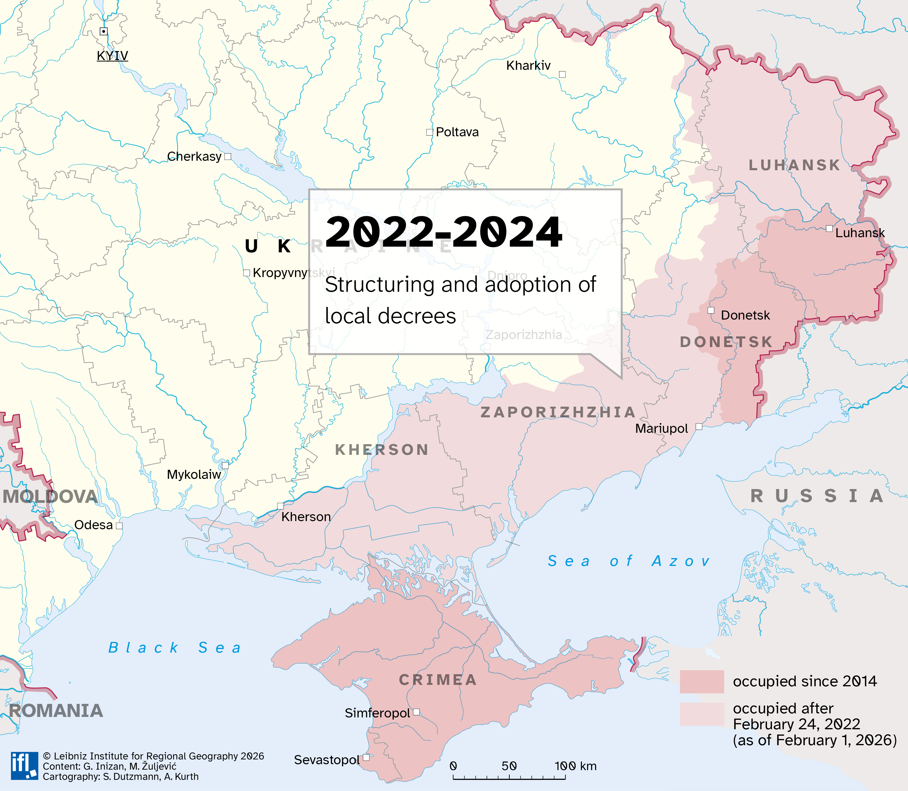
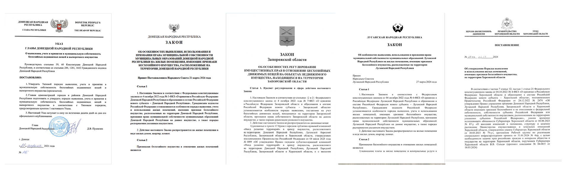
In the spring 2024, local authorities have since implemented a legal framework to “municipalize” or “regionalize” dwellings considered “ownerless” in a far more systematic way, with regional legal texts that closely resemble one another (see diagram). They outline a similar procedure: identifying potential dwellings, and if no objection is raised within 30 days, registering them as ownerless property, followed by submitting the case to a court to initiate municipalization. In every municipality or region, new lists of dwellings “showing signs of ownerlessness” are now published almost on a daily basis. Across all occupied territories, this involves tens of thousands of properties. Through the adoption of a legal framework at various levels (from the federal to the local), the Russian administration regulates and rationalizes the seizure of dwellings. A bureaucracy of erasure emerges.
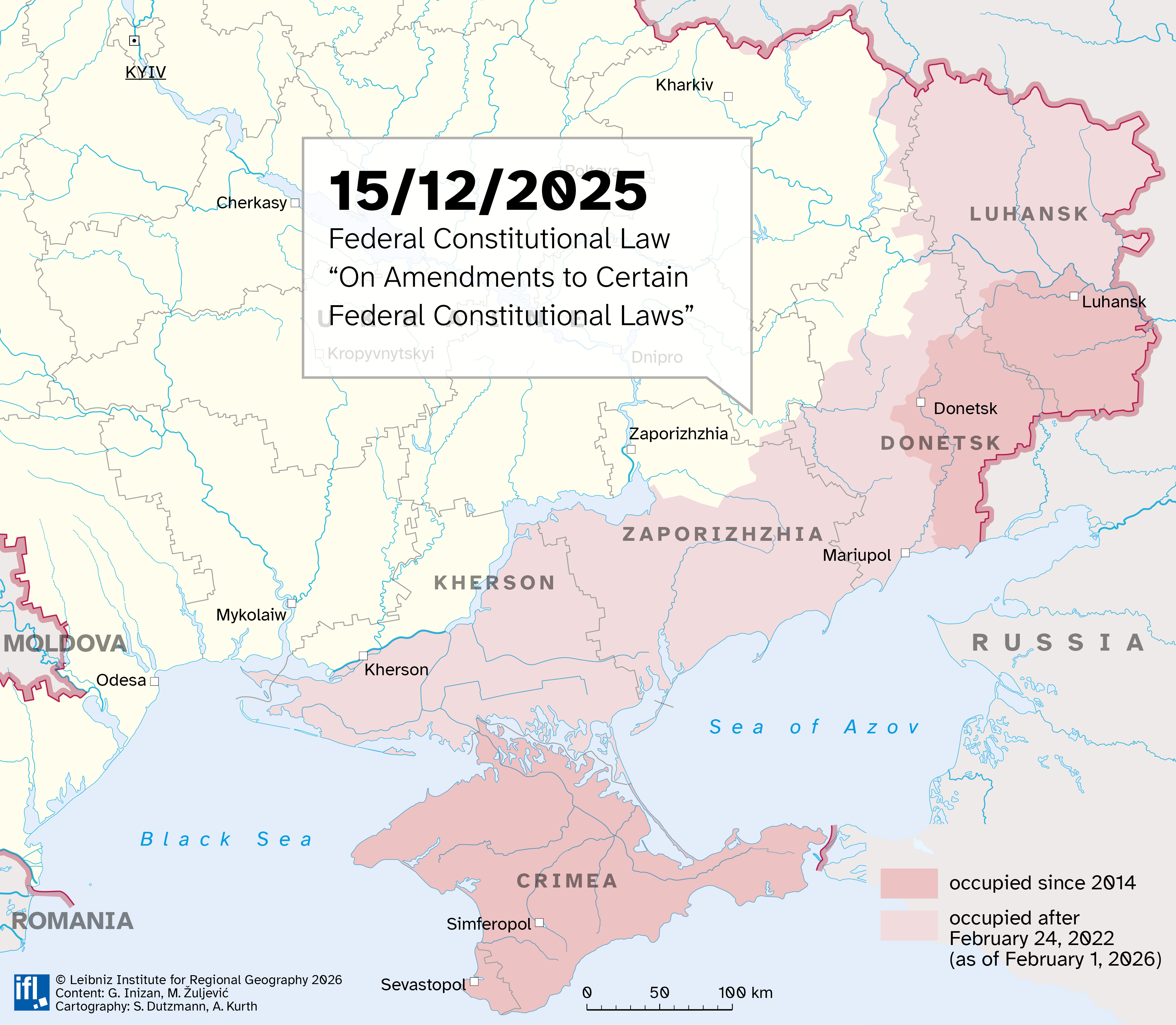
In December 2025, a Russian federal law was adopted to standardize, accelerate, and organize the transfer of property at different levels (municipalization, regionalization, and nationalization) in the occupied regions of Ukraine.
Lists and Laws: How Russia Visibilizes its Administration of dispossession
For the occupying authorities, producing this legal framework and issuing lists that refer to it functions as a tool of legitimation. By generating laws, they act as though the state were capable of governing and resolving an “issue,” while obscuring the fact that they created it themselves: the regulatory texts make no mention of the causes of these “empty” homes, namely war and occupation. The lists and legal texts thus serve as evidence of the occupying authorities’ activities. Moreover, these laws allow the development of a strategy widely observed in Russia: giving the appearance of possible resistance or opposition that is almost impossible to realize in practice but aims at legitimating the actions of the public authorities.
Explore the map below to learn more about specific laws and decrees.
The “municipalization” process also generates extensive administrative activity. A significant share of the official communication from local occupying authorities concerns the identification of “ownerless” dwellings. In this way, the occupying administration performs and displays its power through the bureaucratic work of dispossession.
This process also enables other dimensions of Russification, such as changes in toponymy (dwellings are often listed using street or avenue names introduced by the Russian administration), the restructuring of administrative boundaries, and passportization (a Russian passport is required to prove property ownership). Besides, it remains unclear to whom these properties will be redistributed—some sources mention veterans or civil servants—but it is already evident that recipients will need to obtain Russian citizenship, as is now required of all people living under Russian occupation. Both the municipalization and the redistribution contribute to making the state function.
The Russian occupiers therefore make this confiscation of property rights visible: these laws and documents are accessible, and the process appears transparent and contestable. In a context where access to information is extremely restricted, and were expressing a reality different from that portrayed by the Russian authorities is dangerous, these administrative traces play an even more significant role in shaping the narrative of erasure.
From 'signs of ownerlessness' to municipalization
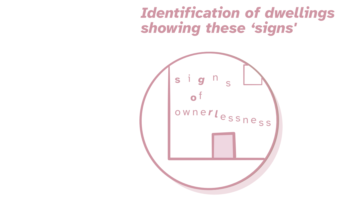
All these laws adopted in the spring of 2024 by regional parliaments are very similar in the procedures they regulate. They all first provide a common definition of what would constitute ‘signs of ownerlessness,’ namely:
- non-payment of communal services for more than one year (Zaporizhzhia, Donetsk, and Luhansk regions) or six months (Kherson region),
- the absence of any information on property rights in the cadastre register,
-
lack of use of a dwelling showing signs of potentially dangerous deterioration (no further details are provided beyond these broad categories).
Next, they follow similar stages:

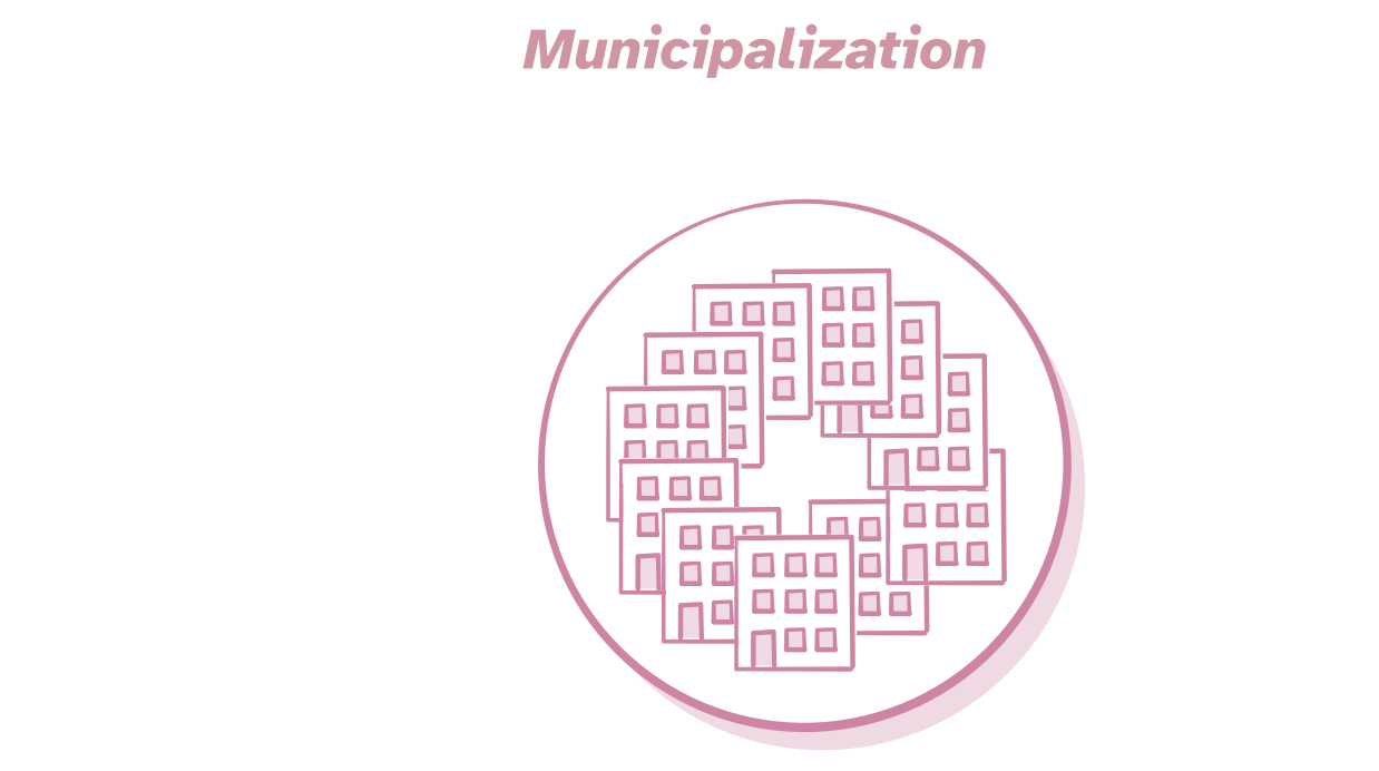
The laws, describing this stage though in a rather vague manner, read that individuals or legal entities can report dwellings exhibiting ‘signs of an ownerless property’ to the local Ministry of Property and Land Relations. This Ministry then forwards the information to the federal and regional services responsible for property and cadastral matters. Within ten days, the addresses of dwellings showing ‘signs of ownerlessness’ must be published on the local administration’s websites and in an ‘accessible place’ near the entrance of the dwelling.
The dwelling is added to the list of ‘ownerless properties’ if no one claims the property and/or occupancy rights within 30 days after the publication of its address. Claims require, in addition to proof of occupancy and/or property titles, identity documents recognized by the Russian administration, and must be submitted to the Ministry of Property and Land Relations.
Following a series of procedures outlined in these decrees, including filing a petition with the court by local housing authorities, the Ministry can transfer the property into the municipal housing stock.
Mapping to unpack the visibilize occupation practices
The sources provided by the Russian administration are abundant: to demonstrate that it rules over the territory, it documents its own crimes—borrowing the expression of historian JD1 regarding the lists of heritage monuments seized by Russia in occupied Ukraine. In a context where access to other sources is largely limited, these official lists also allow the foundations of an alternative narrative to be laid. In other words, they make it possible to challenge the dominant narrative by using data provided by the authorities:
-
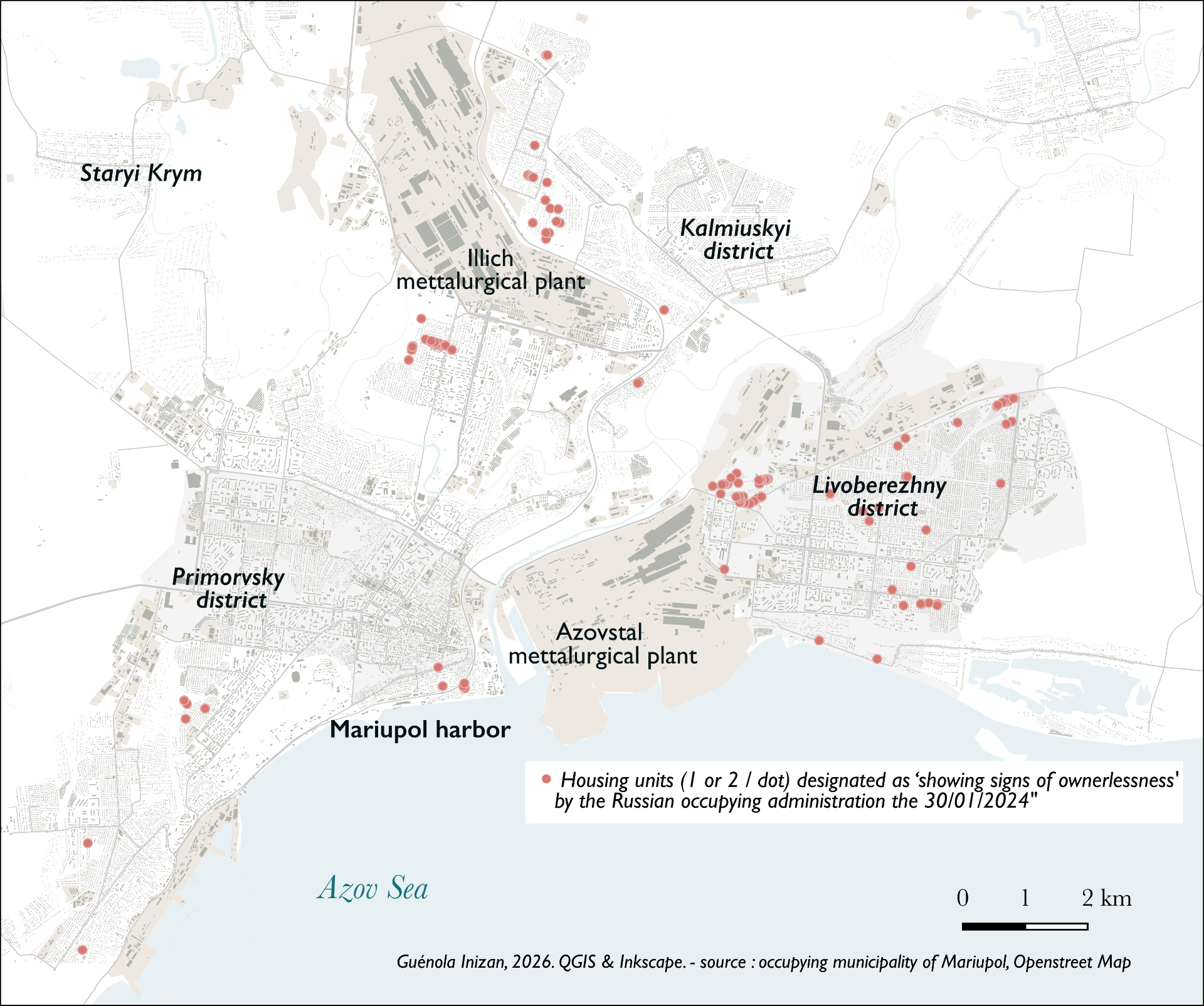
First, by making the phenomenon visible. The lists of buildings subject to municipalization are numerous, provide evidence, and confer legitimacy, but they are not centralized, appear through various journalistic investigations, and in inconsistent formats. Whether this is part of a deliberate strategy or a form of improvisation, it makes it difficult to measure the scale of the phenomenon and thus to objectify it. Early journalistic work has shown the effectiveness of centralizing all lists at the regional level. This can be seen, for example, in the city of Mariupol [cf. map], where it was found that this represents about 11% of the residential stock (among housing that is not completely destroyed).
-
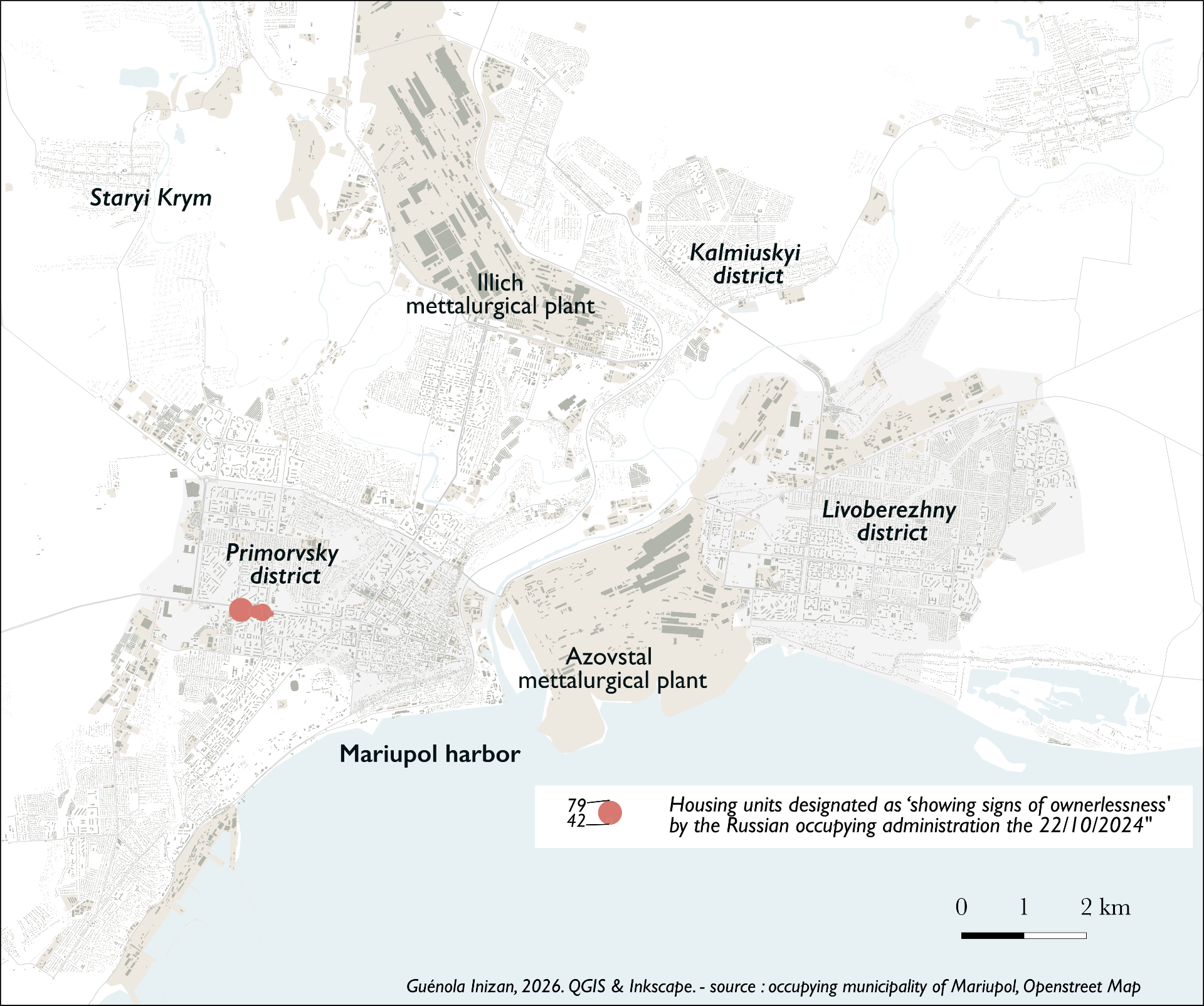
Secondly, by revealing spatial patterns in the implementation of municipalization. Neither the laws nor the address lists indicate how the identification of housing is carried out in practice and they hide micro-scale practices and logics (reports of absence, conversations, individual interests at stake...). Without fully resolving these questions, mapping nonetheless allows some phenomena to be observed: the areas most affected, the spatial distribution of municipalization, etc. For example, in Mariupol, on certain days, the distribution of dwelling lists appears scattered, which may suggest a largely ad hoc process carried out by individuals or at least, quite spontaneous or bottom-up practices (Fig 2, list of potential "ownerless" dwellings published on 30/01/2024). In contrast, at other times (Fig 3, list of potential "ownerless" dwellings published 22/10/2024), the listed housing is highly concentrated, seemingly indicating a more systematic procedure. This provides a foundation for further analysis when combined with OSINT data or personal accounts, while broader access to firsthand information remains pending.
ABOUT THE AUTHOR
Guénola Inizan is a postdoctoral researcher. After defending her PhD in Geography and Planning on the “Renovation" programme in Moscow at Lumière Lyon 2 University (2024), she worked on housing and urban policies in occupied Ukraine at the Leibniz Institute for Regional Geography (Germany), the Department of Geography at the University of Łódź (Poland), and the Lviv Center for Urban History (Ukraine). She is a member of the project "Occupied and Erased: Stories of Ukraine’s Lost Homes”.
- Intention
VisLab: With the atlas case, and to expand on the maps you already produced, we wanted to make the "bureaucracy of erasure” more visible by using maps, but also throughout the text of the case study. We use simple maps to articulate the timeline of how this bureaucracy developed, but also images of the cover pages of documents, icons for specific administrative steps, as well as bolded text that indicates all the different - sometimes mundane and absurd - elements of this bureaucracy.
Guénola: This case also seeks to draw attention to the fact that occupation is an evolving phenomenon that involves work of destruction, including the development of administrative structures aimed at invisibilizing and suppressing existing appropriations and representations of space. Examining what is being implemented helps to deconstruct narratives present in some Russian discourses, particularly official ones, which aim to naturalize and normalize a unity between Ukraine — especially the currently and temporarily occupied territories — and Russia. This representation relies on processes of erasure that this analysis seeks to highlight.
- Base map for representing the laws and decrees
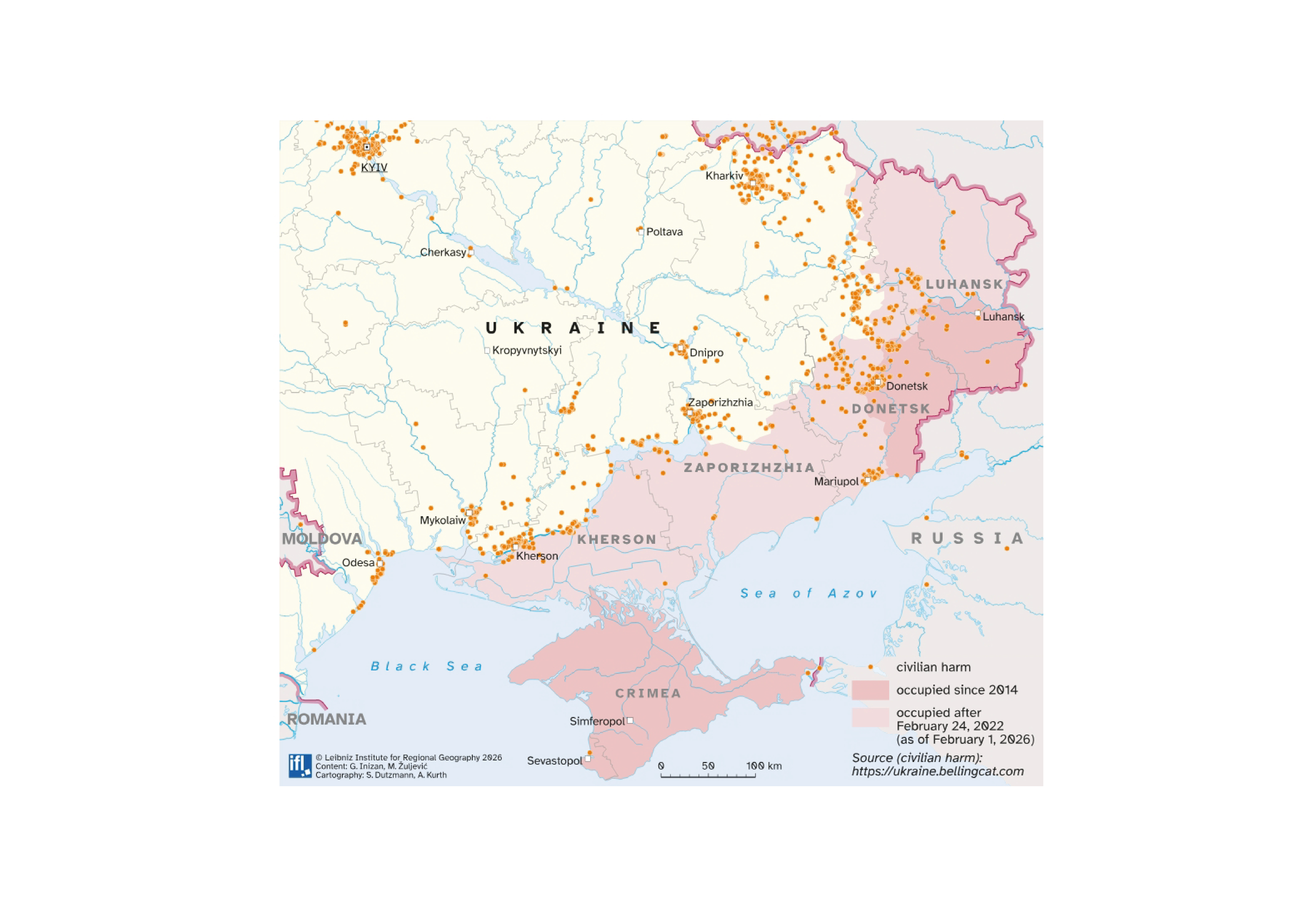
VisLab: These laws and decrees, as the entire bureaucratic process, obscure the violence of destruction and dispossession by which the housing units are municipalised. We started with the base map showing occupied regions, where we wanted to visualise the different laws and decrees adopted. However, it was important to visualise also the violence behind it. For this, we opted to use the dataset from Bellingcat on the civilian harm in Ukraine (Civilian Harm in Ukraine Timemap - Bellingcat).
Guénola: This map illustrates a common strategy of Russian authorities, both inside and, as in this case, outside Russia’s acknowledged borders: legalizing crimes in order to legitimize them. It aims to show how the adoption of pseudo “legal” texts constitutes one weapon among others used to appropriate a territory that is controlled de facto but illegally under the international legal framework.
- Counter-maps
VisLab: Guénola was a fellow at Leibniz Institute for Regional Geography when she started making counter-maps which traced how administration works in space and if there are some spatial patterns emerging in this. This involved a complex technical process of going through the lists and georeferencing the data. Could you tell us more about this? What insights of bureaucracy of erasure did you reach while engaging in this process and its technical side?
Guénola: This georeferencing was made by downloading lists of housing units labeled as potentially “ownerless”, published by Russian occupying local administrations on their local websites. Through a code built with the help of colleagues of the department of Cartography and Visual Communication, it was possible to map the dwellings that were about to be seized. This revealed not only the scale of the housing confiscation process (over 13,000 just in the city of Mariupol for the period studied, see map), but also other transformations instituted through these “legalization” and “listing” operations. For example, the administrative network was slightly altered by the Russian occupying administration, in a long-established gesture of colonial appropriation of territory. This tactic of control also creates difficulties for critical observers in properly comparing dynamics before and after the occupation, including the proportion of housing seized within specific districts or administrative boundaries, which have been changed. Toponymy was also partially altered by the occupation authorities, with some Ukrainian names replaced by Soviet or Russian ones. A notable example is Freedom Avenue, which had been renamed by the Ukrainian authorities after 2014 as part of the “decommunization” laws following the outbreak of the war in Donbass and the Russian annexation of Crimea; it is now called “Lenin Avenue” by the Russian occupying authorities.
VisLab: Your method could be seen as a form of counter-mapping, could you tell us a bit about your understanding of this?
Guénola: Counter-mapping aims at showing realities that are often hidden by dominant powers. This approach was particularly developed as a tool to make visible the material and symbolic Indigenous forms of appropriation of space in (post)colonial contexts, in which realities are often deliberately concealed by colonial maps which present lands as “empty” or “blank” in order to legitimize conquest or the appropriation of land. Russia's occupation of Ukraine follows this colonial logic of erasure and the invisibilization of existences, systems of property, and social structures. Several projects, drawing on narratives of exile, highlight the former existences that Russia seeks to erase. In this case of the visual atlas, the aim is also to counter the narrative that legitimizes the occupation, but by adopting an alternative point of view: documenting the “work” of erasure itself. Although Russia has adopted a legal framework and makes this policy public, the maps and visual representations produced by the occupation authorities do not focus on this aspect; rather, they tend to showcase the new landscapes and buildings Russian occupation authorities are producing, as well as the integration into Russian national territory. In contrast to these maps and representations, which aim to normalize the Russian occupation, and even render it appealing, the visualisations and maps we produce here seek to show that this so-called integration is in fact a violent annexation, involving a form of colonial bureaucratic work.